

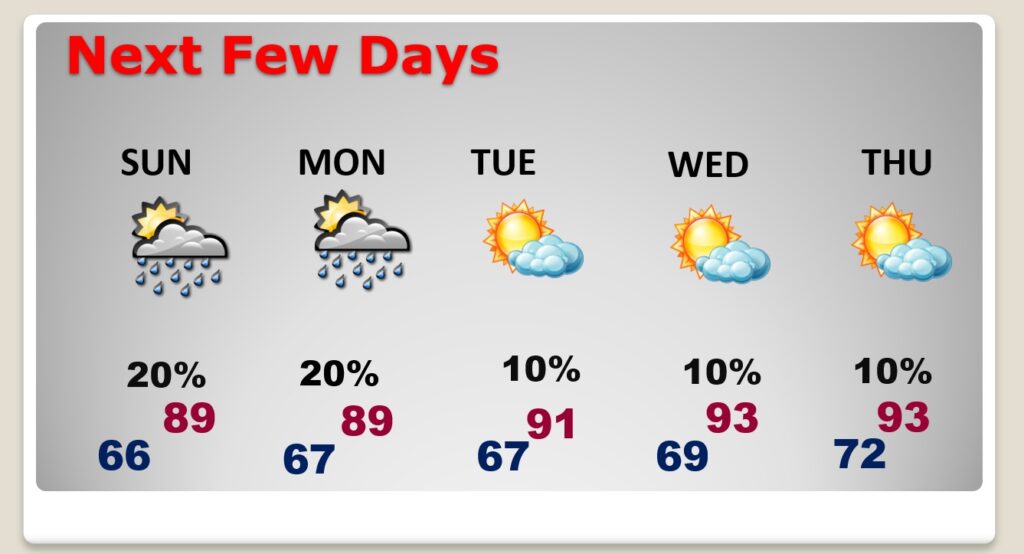
Good morning! Some towns got wet Friday. There were more showers than expected. Random showers & storms will return to the radar today. The risk of “hit or miss”, random, showers and storms will be in the forecast through Monday. It will continue very warm. It feels very much like a typical summer weekend. Highs today & Sunday will continue in the upper 80’s, with 60’s at night. Next week will be very warm. We could be close to record highs by Wednesday.
TODAY: Sun/cloud mix. Very Warm.. Highs in the upper 80’s. Scattered random hit or miss storms. Partly Cloudy very mild tonight. Low 66.
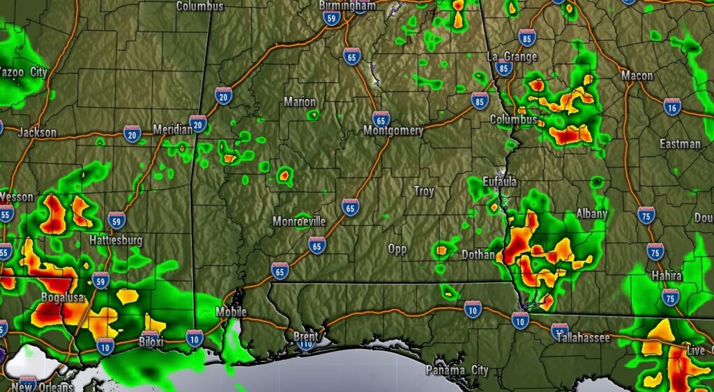
Future radar this afternoon. More random “hit or miss” showers and storms.
NEXT FEW DAYS: It continues very summer-like.. The risk of “hit or miss”, random, showers and storms will be in the forecast through Monday. It will continue very warm. Highs Sunday and Monday will continue in the upper 80’s, with 60’s at night. Next week will be very warm. We could be close to record highs by Wednesday.
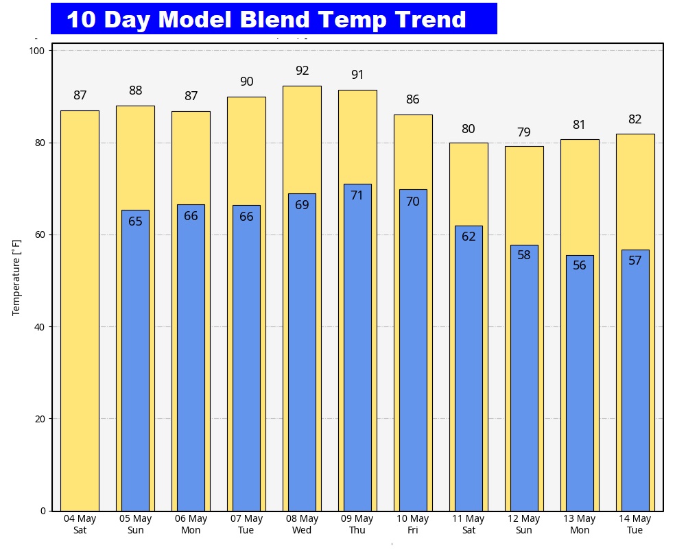
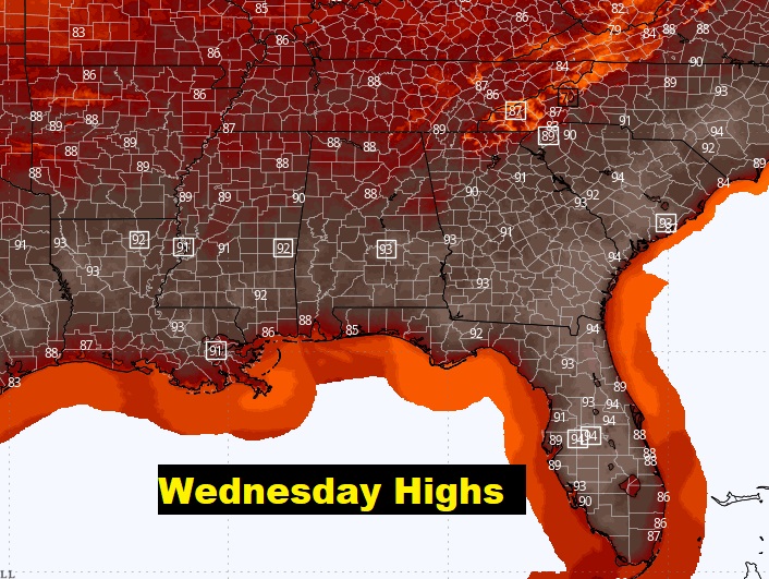
Here’s the 10 day temperature trend. Near record warmth by Wednesday. A little cooler the following weekend.
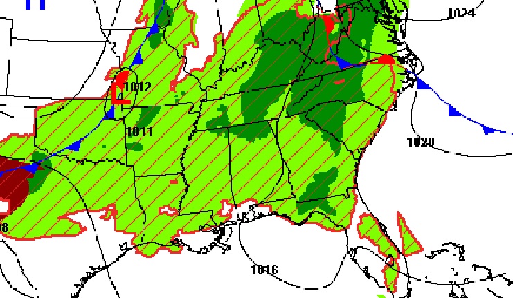
Here’s rainfall through Monday. Rainfall mounts will be rather sparce in south Alabama. None on the coast.

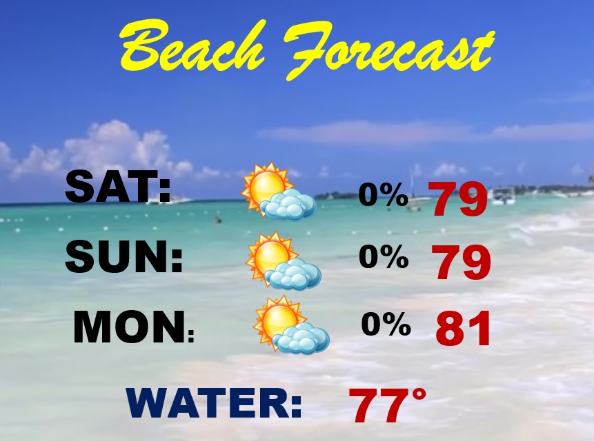
BEACH OUTLOOK: Still, very nice.. A sun/cloud mix. Comfortable. Dry. Highs near 80. Gulf water temperature is 77. High Rip current risk through Sunday.
Thanks for reading the blog. The next scheduled blog will be Monday morning, Have a nice weekend!
–Rich