
Good morning! Precious raindrops are drenching the area this morning as low pressure slides eastward across the Gulf coast. The rain threat will end this morning. Improvement is in the cards by this afternoon as sunshine breaks out. Cooler air is moving in for a couple of days and nights. Very chilly Jacket Weather nights are expected tonight and Sunday night with lows in the middle 40’s. But, expect a nice warming trend Monday through Wednesday. That next storm system by Wednesday night needs to be watched. Already, five days out, the Storm Prediction Center shows a big chunk of the state in a Severe Weather Risk. That would most likely be Wednesday night and pre-dawn Thursday, including all modes of severe weather.
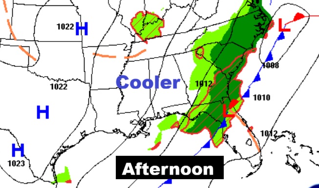
TODAY: Risk of rain mainly this morning. Afternoon improvement. Gradual clearing. High 71.
(Normal hi/lo 82/57)
TONIGHT: Clear and very chilly. Jacket weather. Low in the middle 40’s.
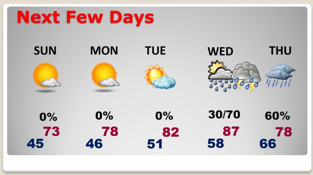
NEXT FEW DAYS: Nice Sunday. Sunshine: Low 70’s Warming trend and very nice Monday and Tuesday. Mid to upper 80’s Wednesday. Potential Severe Weather event Wednesday night and pre-dawn Thursday. Stay tuned. More below.
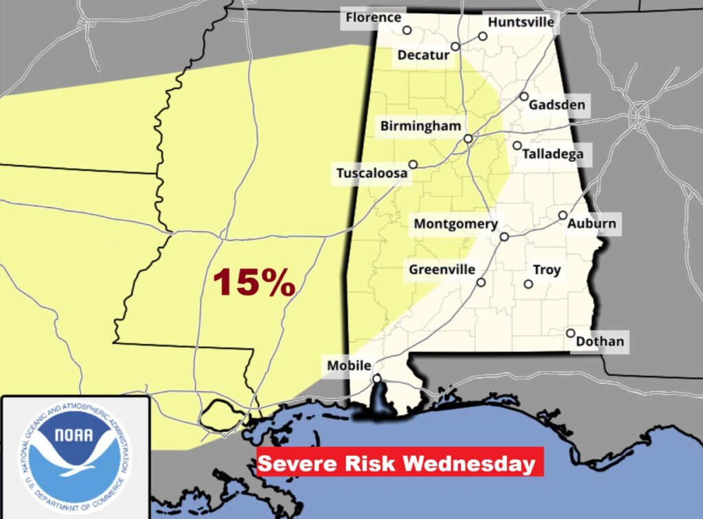
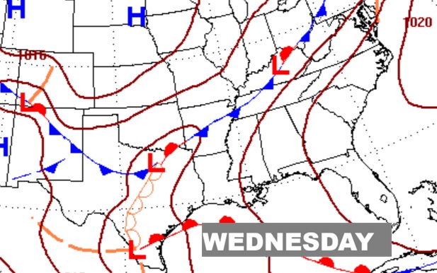
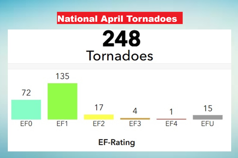
MID-WEEK SEVERE THREAT: The next storm system by Wednesday night needs to be watched. Already, five days out, the Storm Prediction Center shows a big chunk of the state in a Severe Weather Risk. That would most likely be Wednesday night and pre-dawn Thursday, including all modes of severe weather. Currently a 15% risk covers much of west Alabama. That would equate to a Level 2 risk. Almost certainly, when we get into the 3 day window, a Level 1 risk would likely cover a much larger area. We’ll have time to watch this storm system. It’s interesting to note, there were 248 tornadoes in the middle of country in April and NONE in Alabama. First time in 22 years. Very rare scenario indeed.
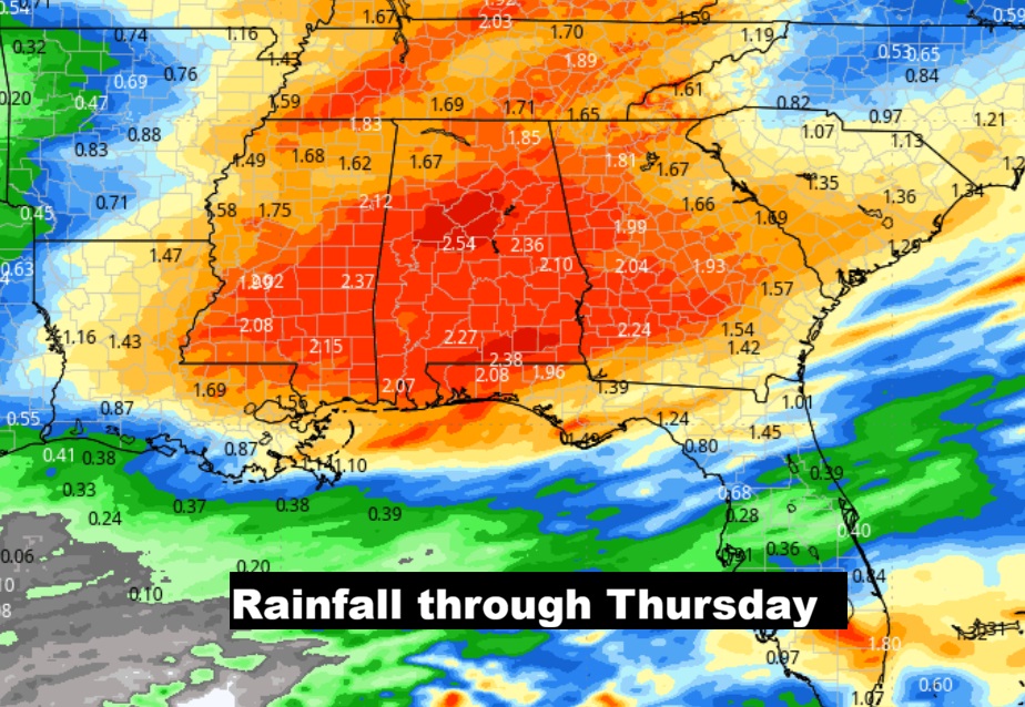
EXPECTED RAINFALL: Apparently the models think that mid week storm system could be very generous as far as rainfall.
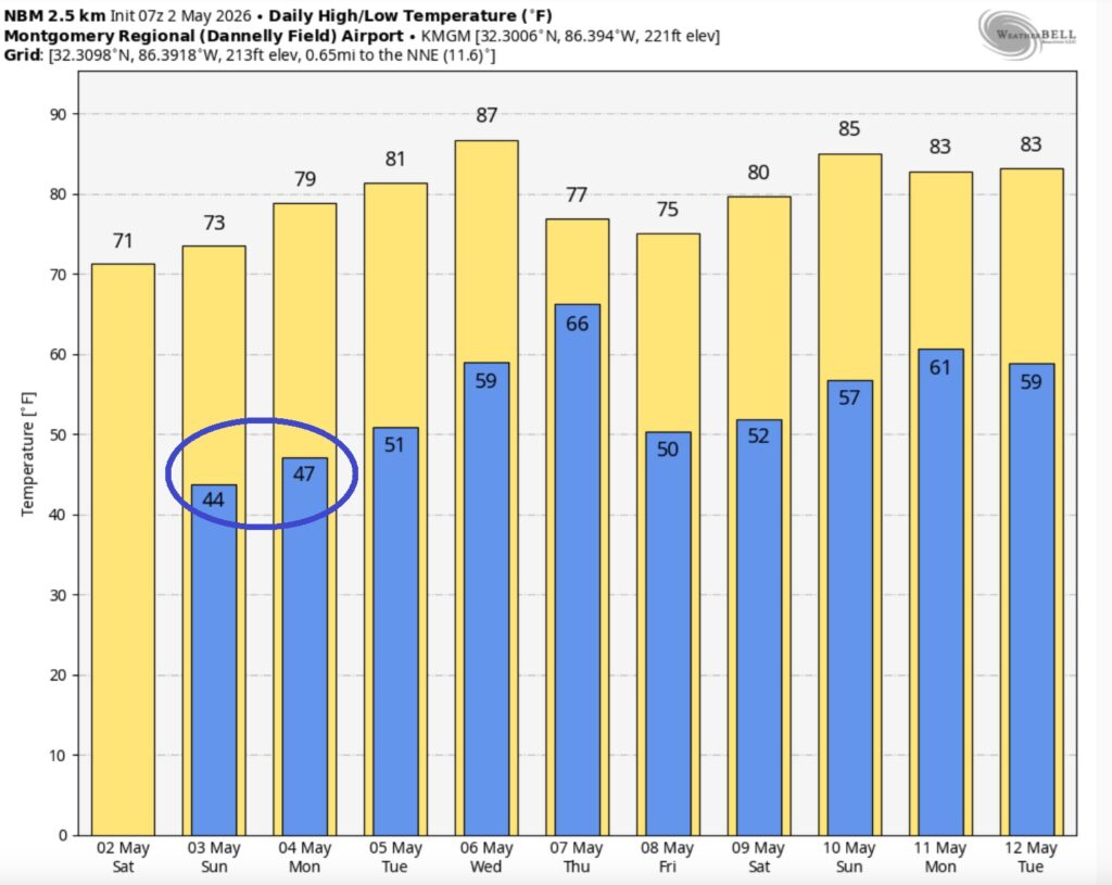
The 10 Day model Blend Temperature Trend. Way below normal this weekend. Warming trend starts Monday.
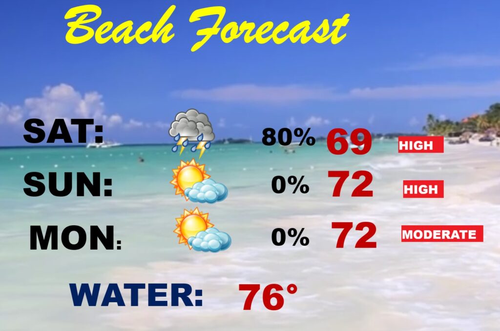
BEACH FORECAST: Today looks wet for a big chunk of the day. Sunday looks a lot better. Monday will be a nice day. High Rip Current Risk today and Sunday. Mid-week storm system.
.
Thanks for reading this Blog this morning. The next scheduled complete Blog update and Video Forecast Discussion is scheduled for the 4 o’clock hour on Monday morning. Have a great weekend.
-Rich