
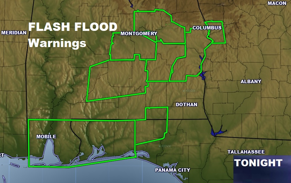
What a day. What a night. What a weekend. Yes there were tornado watches and severe thunderstorm warnings and a handful of tornado warnings, but this weather situation will be remembered for prolific rainfall amounts. Rainfall amounts of 5-7” are common since Saturday. Especially today! Many spots in central & south Alabama have had 3-4 today! This obviously has caused flooding of many low spots and streets and roads are impassable in spots. No doubt creeks and rivers are rising. Be very watchful in normally flood prone areas. Here’s a look at some of the Flash Flood Warnings.
Rain and thunderstorms will diminish from the west later tonight. We’ll dry out tomorrow with partial sunshine and a high of 71. Much colder air is ahead later in the week, especially Thursday through Saturday. Join me tomorrow morning for your regular video at 5. We’ll talk about the winter blast. How cold will it get? Could there be e brief rain/snow mix Friday night/Saturday AM? I’ll run it all down for you with the latest information. Join me in the morning at 5.