The January chill is settling in. It’s the coldest we’ve been in roughly 3 weeks. I’ll update you on how cold and for how long. Quiet pattern for now. I’ll update you on any storm systems on the horizon. New Drought monitor map. And, if you missed last night’s excellent Space Station flyover, there’s another one this weekend. With your toast and coffee this morning, here’s your Friday morning personal weather briefing.
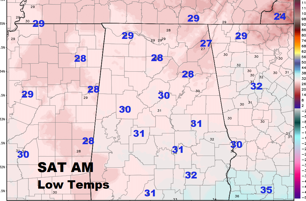
Saturday Morning Lows: First freeze in almost 3 weeks.
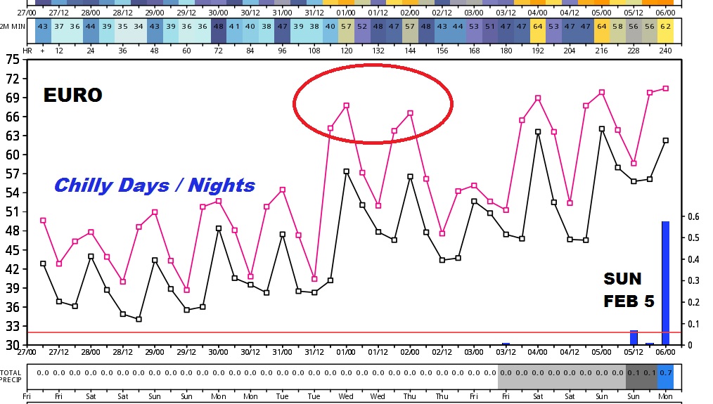
Euro Model out 10 days. The graph shows the Chilly January air for the next 4 days, followed by mid week warming. Next storm system maybe 9-10 days away around February 5.
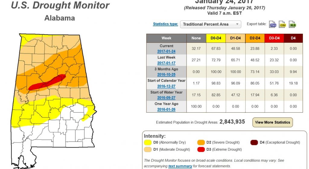
New Drought Monitor shows good news. The Drought continues to quickly shrink.
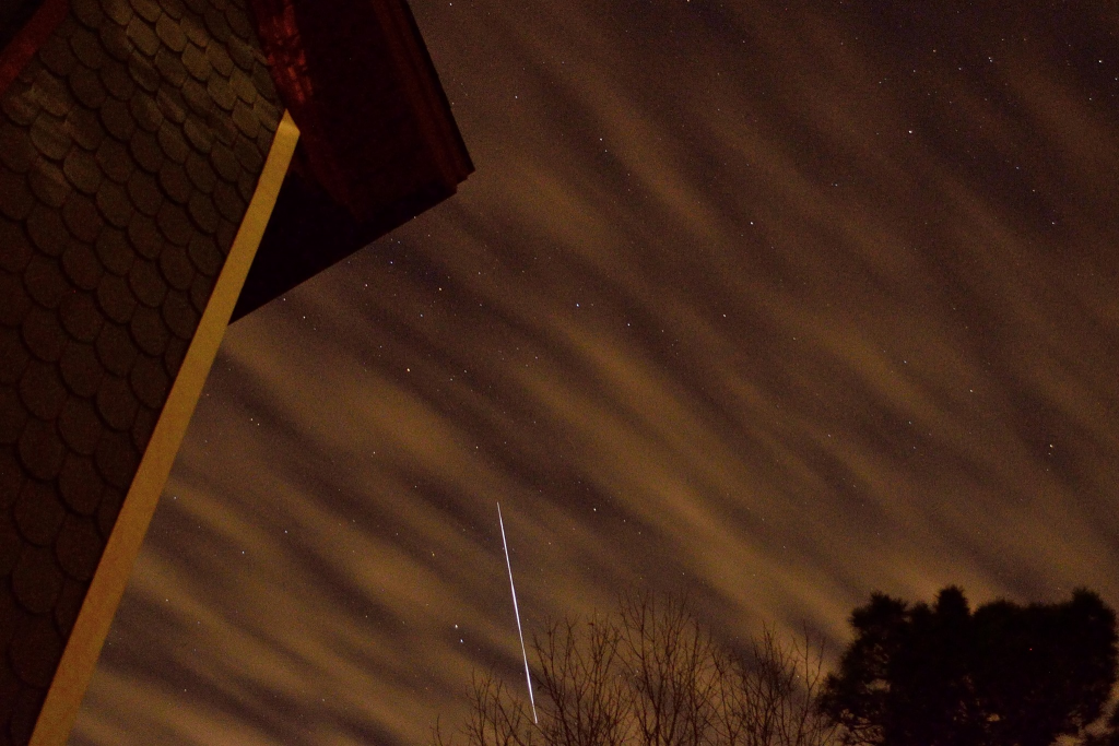
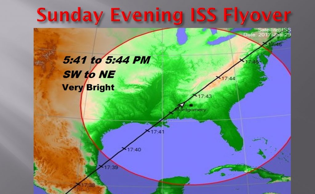
If you missed Thursday’s night great Space Station Flyover, there’s another good one Sunday evening, from 5:41 to 5:44. From the southwest sky to the Northwest sky.
Barry Simmons took this great time exposure shot of last night’s flyover, up at Lake Martin.