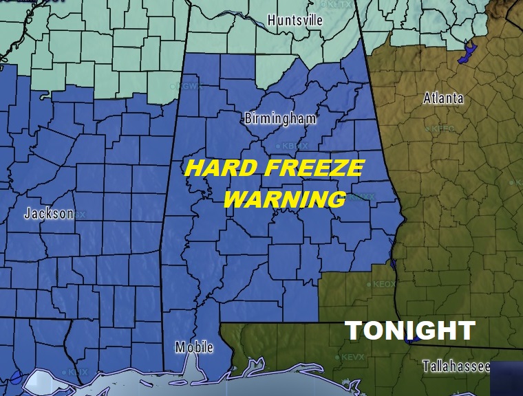
Are you ready? We are about to experience a prolonged period of Arctic cold air lasting several days. There will be a series of hard freezes through the whole week. A big chuck of west central Alabama could see a light wintry mix, enough to make travel slippery today. Most of us will see only rain. Hard Freeze Warning tonight. We’ll be below freezing before the New Year arrives and old man winter will stay us for several days in a row. Relentless cold. Details below.
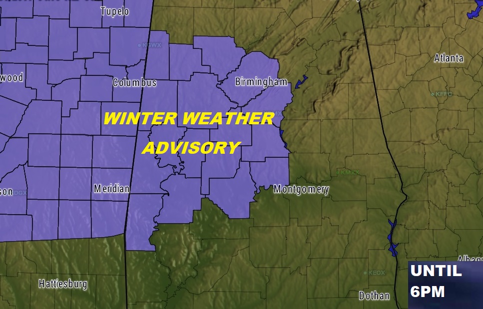
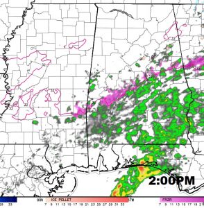
WINTER WEATHER ADVISORY: West central Alabama could see a very light wintry mix of freezing rain and sleet today from about dawn to 6PM. This includes areas generally along and north of a line from Selma to Marbury. It includes counties as far east as Coosa, Autauga and Dallas. The ice accumulation could cause slippery conditions on some roads and especially bridges and overpasses.
TODAY: Outside of the Winter Weather Advisory area, for most of us it will be just a cold light rain today, ending by early evening. Temperatures will fall from the low 40’s this morning to the mid 30’s by late afternoon. Could there be a brief mix before the precipitation exits? I suppose it’s possible but not likely. Tonight, will be cloudy early followed by clearing and much colder. A Hard Freeze Warning is in effect.
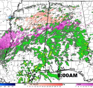
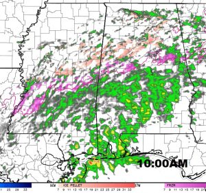
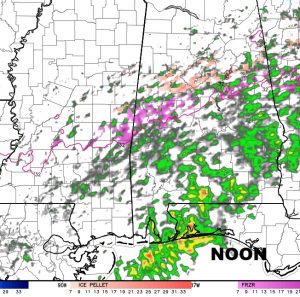
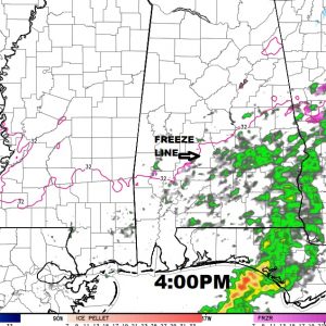
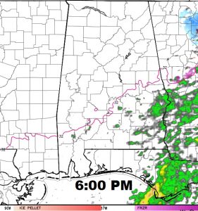
Future radar shows the progression of the precipitation, as it slides southeastward today through early evening. Purple is freezing rain, pink is sleet. Most of us will see just rain.
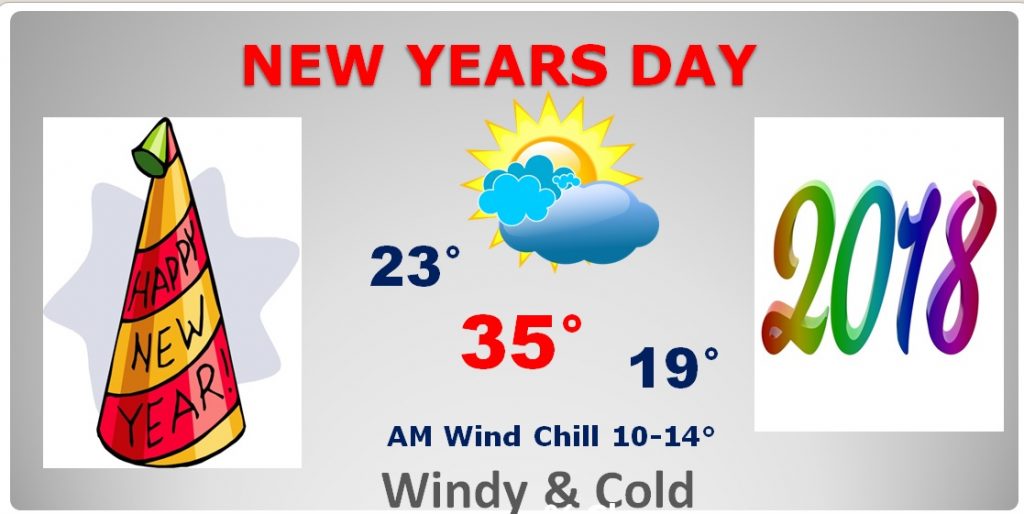
MIDNIGHT NEW YEARS FORECAST: If you are heading downtown for Montgomery’s big celebration, the good news is we should be dry. But, bundle up! I expect 29° at Midnight with a Wind Chill in the upper teens. Dress in layers.
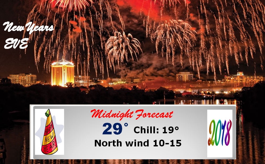
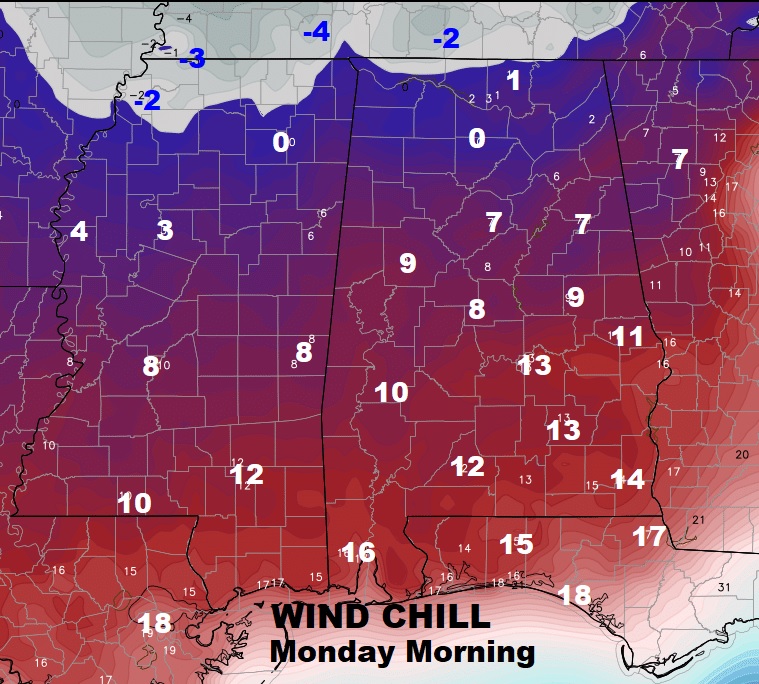
New Years day will be brutally cold. The morning wind chill will be 10-14°. The actual high for the day will only be 35°, with a low Monday night 19°. Wind chill across the northern counties will be in the singles digits to near or below zero.
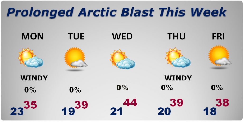
THE WEEK AHEAD: The most important point I want to drive home is – this will be a PROLONGED period of extremely cold weather, with a deep freeze every night for the first week of the New Year.
HARD FREEZE WARNING – TAKE PERCAUTIONS: Remember the 4 P’s: Pets, pipes, people and plants Wrap any exposed pipes that need attention. Protect any sensitive plants that need to be brought in. PLEASE take care of your pets! Bring them inside. Make sure they have a warm shelter to stay in. Please check on your elderly neighbors. Dress in layers. Use hats, gloves and scarves. Be careful using space heaters and use extreme caution with fireplaces.
Be ready for several nights of Hard Freezes throughout New Years week. This will not be a quick cold snap.
SUGAR BOWL IN NEW ORLEANS: For anyone headed to New Orleans for the Sugar Bowl, prepare for Winter COLD. TODAY: 40% chance of rain, with Falling temperatures, reaching 44° by later afternoon. TONIGHT: Windy and much colder…Low 29°, wind chill falls to the teens. New Years Day…Windy and very cold. High 38° Wind chill teens and 20’s. Bundle up! Fortunately the game itself will be in the warm confines of the Super Dome.
PEACH BOWL IN ATLANTA: Cold but dry today. Hi 38. Partly cloudy brutally cold tonight…Low 22°, wind chill falls to 7°. New Years Day: Windy & cold, but sunny. Hi 34°. Wind chill single digits.
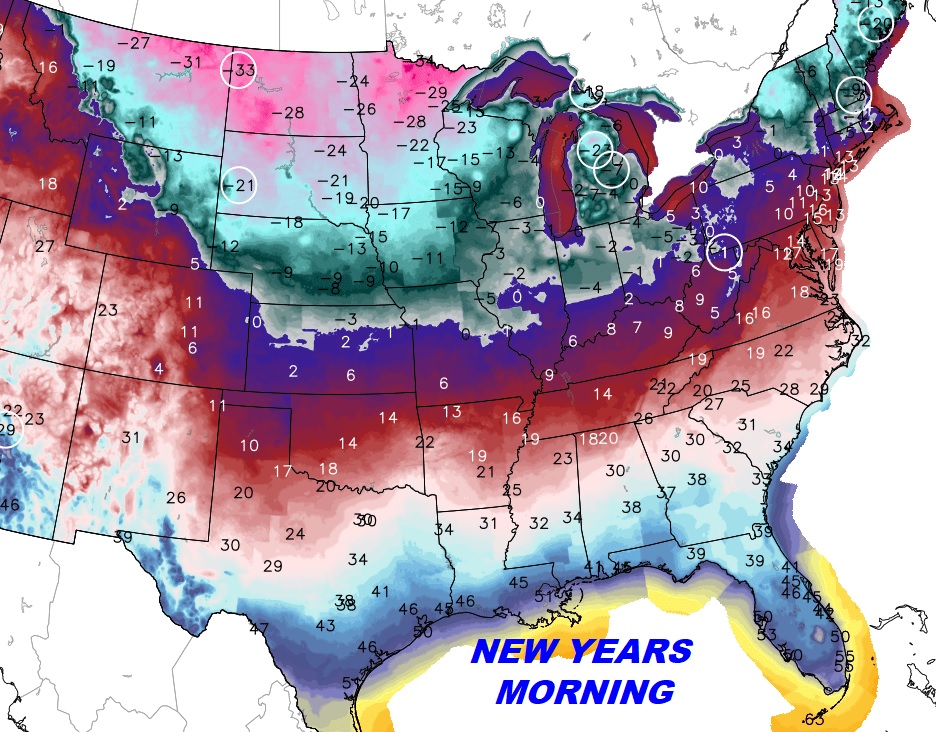
ELSEWHERE: The extreme cold covers more than 70% of the nation. This is a serious prolonged Arctic outbreak.
–
Be ready for the Arctic Cold. Take precautions. I’ll keep you up to date on any changes. Keep our weather app handy. It will give you push notifications for advisories and warnings. Plus hourly forecast and current conditions to keep up with wind chill. Radar and future radar will show you what is falling and where.
Happy New Year!
–Rich
P.S. Bailey is ready for the extreme cold.