Good Morning! Get ready. Winter approaches. This morning’s video is certainly worth your time. New numbers on the big plunge ahead. First, a warm Monday, then a wet Tuesday as the front moves through, then the cold. I’ll show you how much rain we can expect. I’ll give you a peek into late December. With your toast and coffee, here is some very good information for you on your personal weather briefing. Feel free to share this post for others.
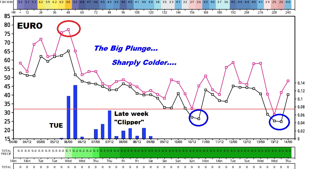
Spring-like today with highs in the 70’s, but a cold front enters the state tomorrow with showers & storms followed by sharply colder weather starting Wednesday and through the rest of the week and weekend. It will be a shocking change of seasons and wardrobe.
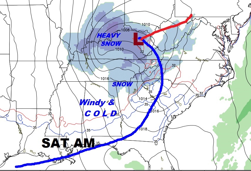
After the rain, it will get progressively colder as the week goes on.

One of the coldest days will be Saturday. It will be a breezy, cold “raw” winter’s day with highs that may not make it out of the 40’s, with snow flurries in northeast Alabama.
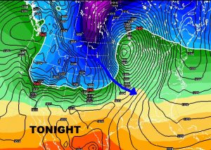
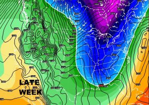
The Global models (The Euro and GFS) profile the drastic temperature drop.
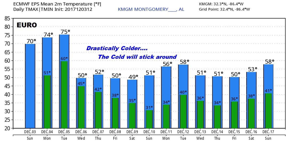
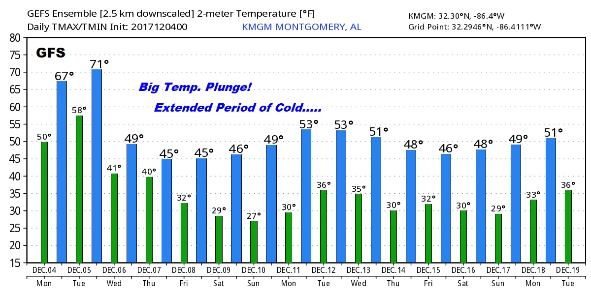
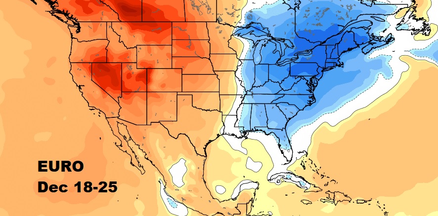
According to the Euro model guidance…the cold may persist well into December, perhaps late December.