
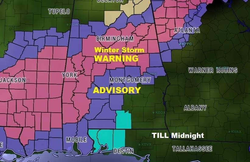
Everybody likes snow…at least most people And, it is a winter wonderland across much of north central Alabama where snow has accumulated quickly to over 3” in spots. But, travel has become next to impossible in spots in the Winter Weather Warning area. This includes the Greater Birmingham area and Anniston/Gadsden, too That situation will continue, because the snow won’t melt. Don’t even try to travel to that part of the state.
Farther south, most of central Alabama is under a Winter Weather Advisory. Temperatures are hovering in the mid 30’s close to lunchtime. A rain/sleet/snow mix has been occurring in many areas. Later this evening, that mix will likely turn to all snow and continue into the nighttime hours before ending late. The temperature will fall. I’m worried about travel conditions which will continue to deteriorate, especially by late afternoon, and into early evening. As skies clear toward morning, the low will reach about 28 by morning. I can’t rule out some black ice issues in the early morning hours.
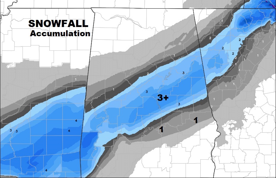
ACCUMULATIONS: Looks like total snow accumulations will reach 3+” in many areas across north central and east central Alabama. Farther south, along the I-85 corridor, I think 1” amounts are possible. South of that area, accumulations would be rather minor.
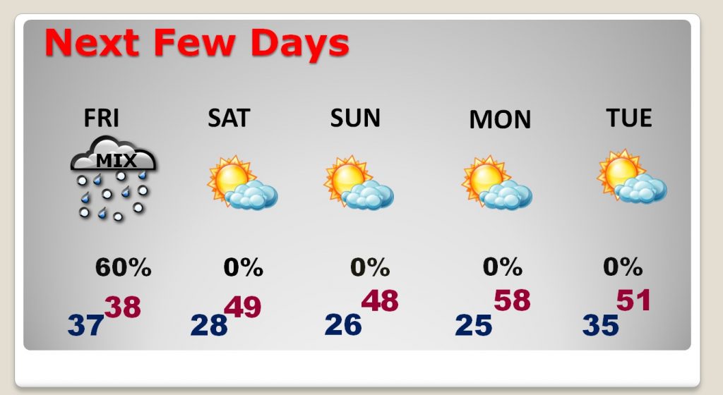
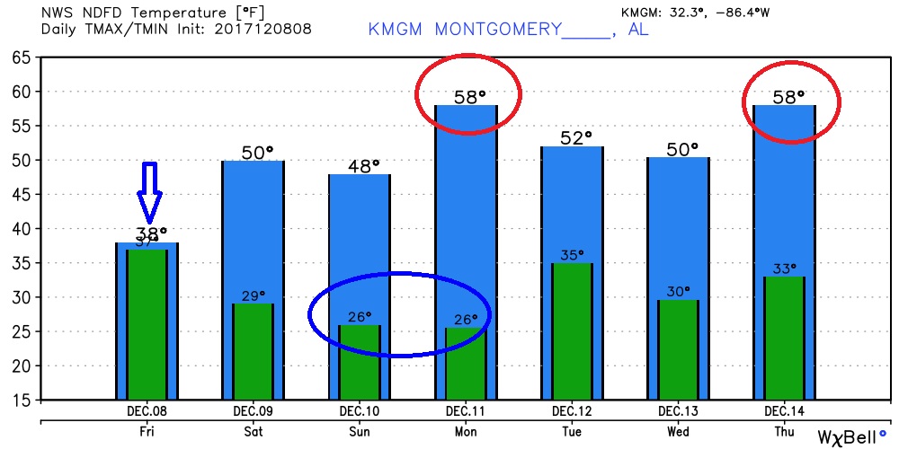
After today, it will still be cold this weekend. We will be in the 40’s on Saturday but winds will make it seem colder. Saturday night and Sunday night we will fall to the 20’s. It will be a little warmer by Monday afternoon before it cools down again Tuesday.
Stay on top of all these winter weather developments with our free weather app. Get it on your phone and tablet today. Just search Rich Thomas Weather. Watch for more updates. If you have to travel, be careful…if you don’t have to…please stay off the roads.
Rich