
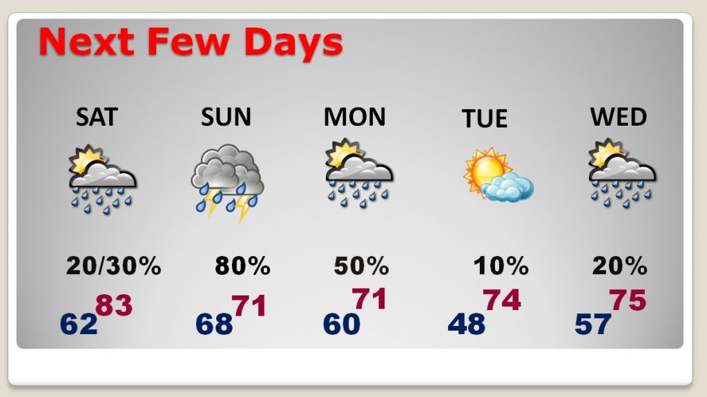
Good morning! We headed back to the low 80’s. If we tie or break today’s record of 83 (from 2017), it will be the 5th record high in a row. But, hang on. Changes are on the way as a front approaches which could bring a severe weather threat to parts of our state tonight, shifting southward on Sunday.
TODAY: There will be more clouds than sun. It will be breezy, warm & humid. Spotty showers can’t be ruled out, especially during the afternoon and evening. Rain chances are small. High around 83, which would tie the record. Low tonight 68.
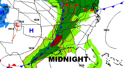
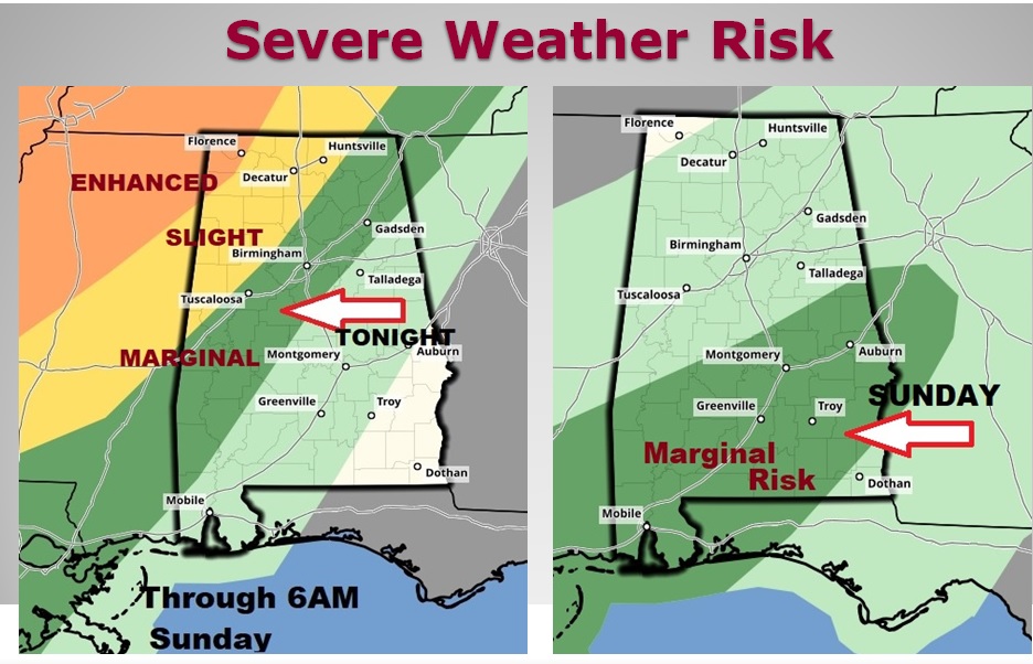
SEVERE WEATHER RISK UPDATED: Overnight tonight, a line of strong to severe storms will enter northwest Alabama. The greatest severe weather risk in our state will be generally north of the I-20/I-59 corridor. But, a Marginal Severe risk extends as far down to near a Clanton to Selma line by 6AM Sunday. Then, during the day Sunday and Sunday night, a Marginal Severe Risk shifts to central and south Alabama. Damaging wind gusts would be the main risk, but brief tornadoes can’t be ruled out. Keep our Weather App handy. It will instantly alert you to a watch or warning for your location.
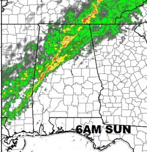
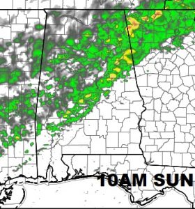
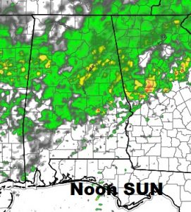
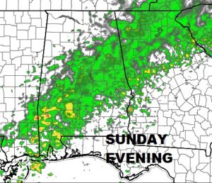
FUTURE RADAR: Here’s just a few sample future radar snapshots from the NAM model for Sunday. It gives you a general idea how the area of showers and storms will be shifting southward through the day and into Sunday evening.
NEXT FEW DAYS: The 80’s will be gone after today. Rain and thunderstorms will dominate the forecast Sunday and Monday. That will be followed by another round of rain and storms by mid week. Cooler days and nights are ahead.
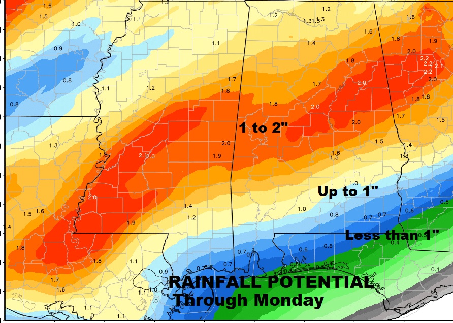
HOW MUCH RAIN?: Hopefully, the rain and storms will wash a lot of this pollen out of the air. Much of central Alabama could see 1 to 2” of rain through Monday, and more rain later next week. Amounts decrease the farther southeast you go. Pick out where you live on this map.
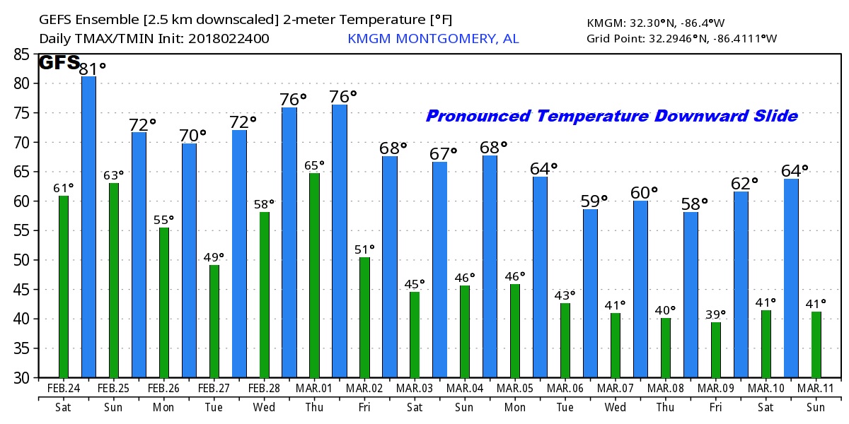
FUTURE TREND – “TEMPERATURE SLIDE”: As we begin the month of March, late next week, our temperature slide will already be in progress. Don’t look at specific numbers, but the trend on the GFS temperature guidance shows a pronounced downward slide through the first 10 days of March. People keep asking me, “will there be any more frosts and freezes?” There almost certainly will. I’d be shocked if we didn’t have more.
—
I will have another complete blog update, again, in the morning, or sooner if there are significant changes. Stay weather aware. Make sure you have our weather app downloaded and allow push notifications for severe weather alerts. Have a great weekend! I’ll keep you updated.
-Rich