Good Morning! Yesterday’s chilly air is retreating, and we have a big mid week warm-up ahead. But, the big story this week involves a Thursday storm system which could bring some strong to severe storms to the state, along with drenching rains. I have the latest on timing, and an update on the severe weather potential. Plus, the latest on an Easter weekend forecast you’re going to like. We have a busy and informative Tuesday morning weather briefing, with your toast and coffee this morning.
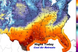
The Cool Wedge breaks down and retreats today, leading to a warmer day.
Great baseball weather at Riverwalk tonight! Comfortable…

Warm-up Wednesday. Potent storm system Thursday. Nice Easter weekend.
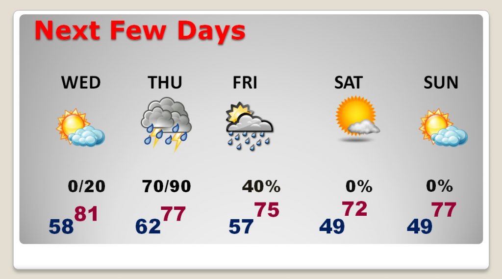
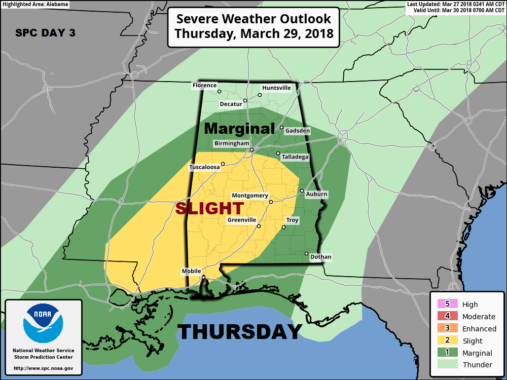
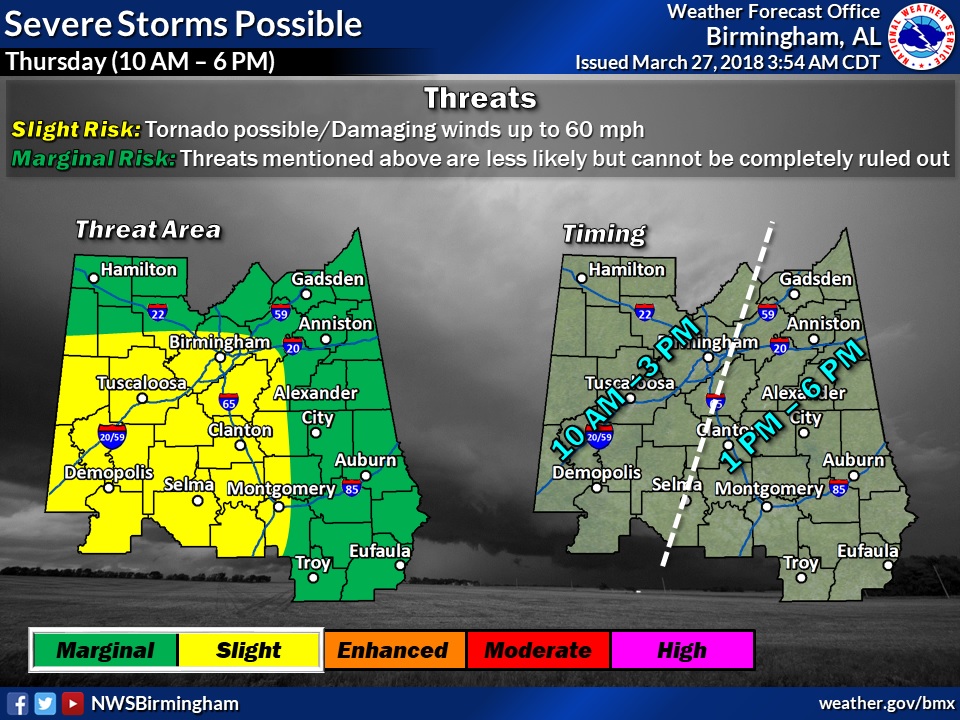
The greatest severe threat is generally along and west of I-65. Tornadoes are not out of the question. Damaging wind gusts to 60+ mph would be the main threat. The eastern counties will see a lesser threat Thursday afternoon.
This Map from SPC shows the wider perspective of the threat for the entire state.