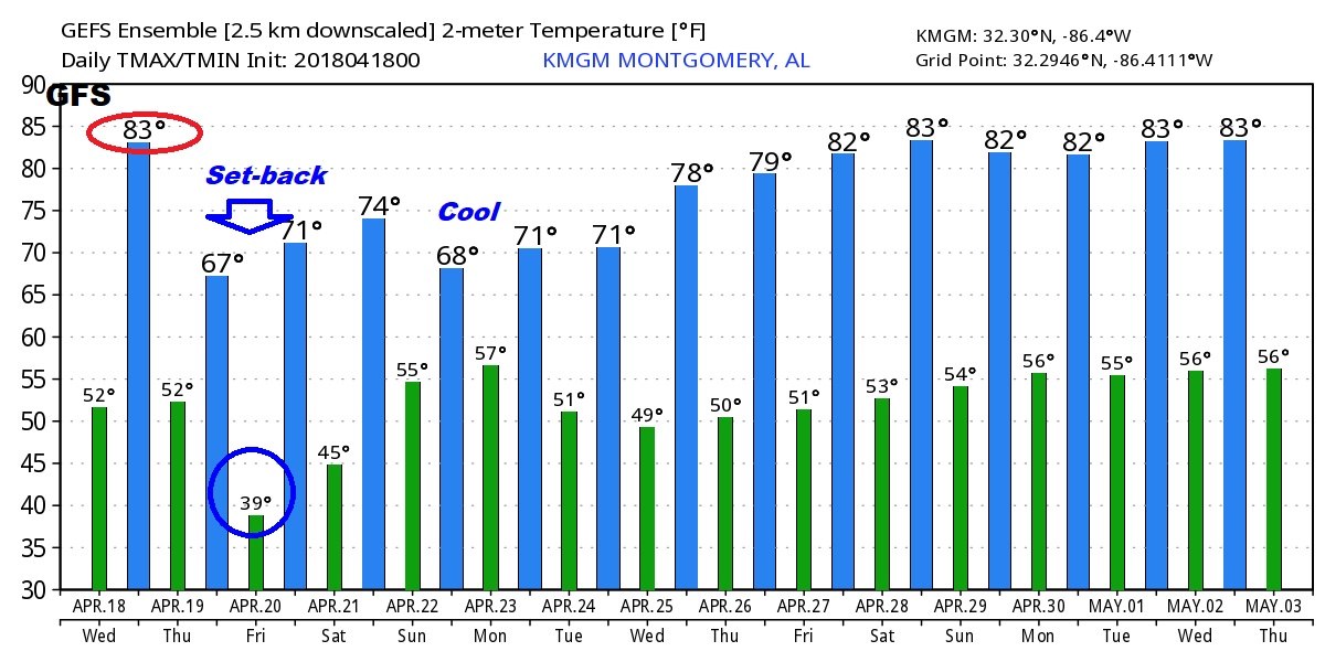
Our Temperature Rollercoaster continues. We’re headed for the 80’s today, cut on this video I’ll tell you about another cold front that will sweep across the area overnight tonight. How cool will it get behind the front? Plus, the latest on the weekend storm system. An update on timing, strength and how much rain to expect. And, it looks like a big pattern change is finally on the way for later in the month. I’ll give you a look ahead to late April and early May.
Warm day today, but another cold front sweeps across the area tonight. Should be mainly a “dry” front. I have the rain chances under 20% but not zero overnight.

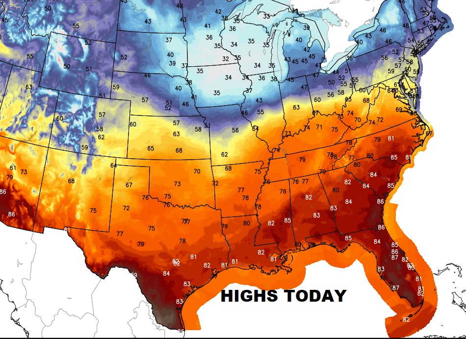
Today will be the warmest day of the week, before another big cool down tomorrow.
Much cooler Thursday and Friday. Coldest morning is Friday morning. Then warmer Saturday, before another storm system Sunday/Monday.
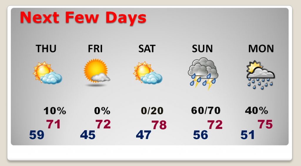
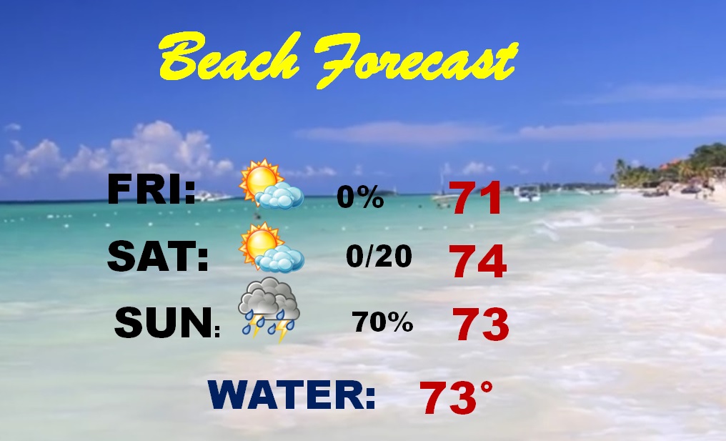
Windy & Cool Friday. Chance of showers late Saturday night and Sunday down at the Beach.
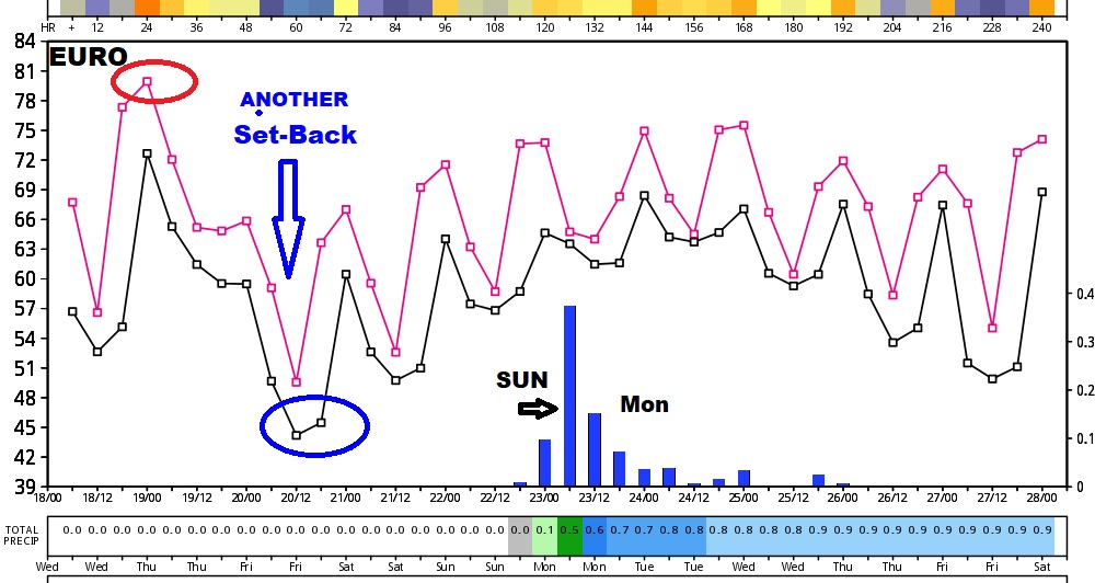
Global models show temperature roller coaster continues next few days.
The GFS starts to show a big pattern change ahead late April and May. Much warmer. It appears the frequent cool downs will be erased.