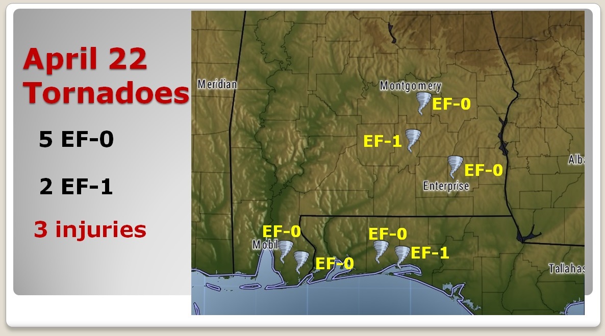
Good morning! Risk of showers continues in the forecast today. I’ll update you on the rest of the week. Looks like we’ll be dealing with another storm system by Thursday. I’m getting more and more excited about the weekend forecast. I’ll show you why. And, I’ll show a map of where the tornadoes occurred Sunday. We had 6 in our region. Have you seen the spectacular footage of the Fort Walton Beach waterspout that came ashore? I’ll show it to you…it’s gone viral worldwide. Lots of good stuff on your Tuesday morning personal weather briefing.
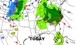
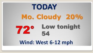
The big, slow-moving eastern storm continues to affect our forecast, as another little disturbance rotates in around the storm bringing another shower chance to the state today.
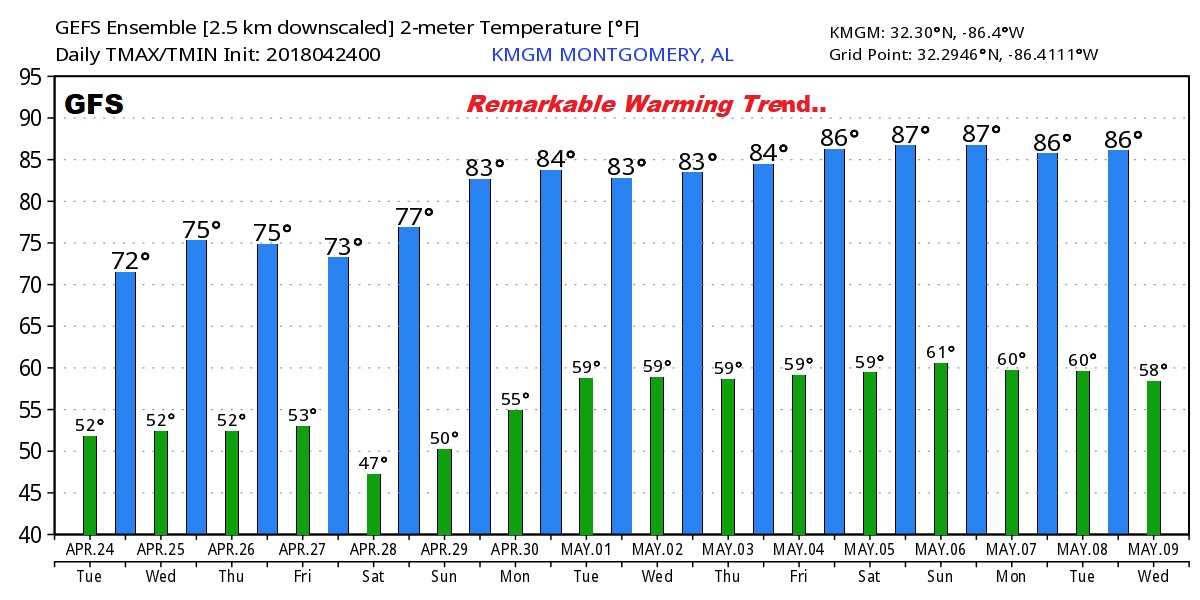
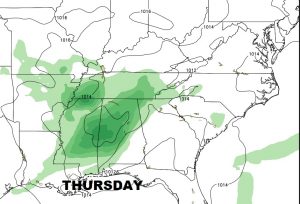
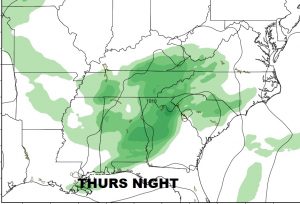
Rain chances are increasing for Thursday and Thursday night, in fact I may have to go up higher in future forecasts. The stage is set for a text book perfect weekend.
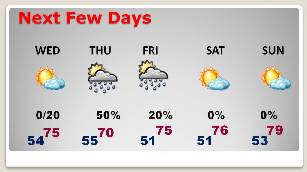
Rain and thunderstorms will affect the area Thursday and Thursday night. So far no Severe Risk from SPC, but I think a few stronger storms can’t be ruled out.
The GFS shows a significant warming trend beginning this weekend and continuing well in through the early part of May.