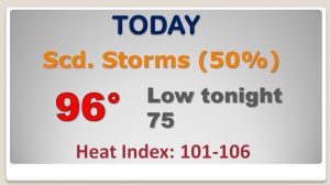
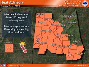
Good Morning! There is much to tell you about on today’s video. We are easing into an active storm pattern for the next couple of days as clusters of strong storms “ride” southward across the area. Heat Advisory Day 4 today. Dangerous heat again. But, what about the weekend? I have updated the details, not only for he weakened, but through the 4th of July.
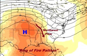
We are in a so called “Ring of Fire” pattern, as storm clusters, ride southward from north to south across the state. Some could be strong to severe. The Heat Advisory Remains in effect for the 4th day.
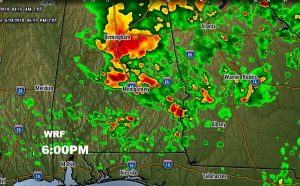
This is just one Future Radar snapshot from just one model. Don’t take the time literally, but during the afternoon and well into the evening, clusters of strong storms will move southward through the state. Some could reach severe limits.
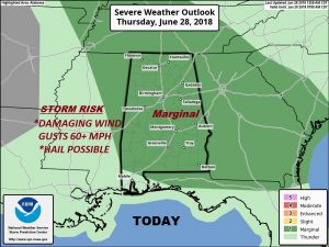
Marginal Severe Risk across much of the state today, but also tomorrow. Damaging wind gusts 60+ mph is the main risk in the stronger storms.
Better than normal rain chances are locked in next few days. Not every town gets wet, though. Triple digit heat index stays in place.
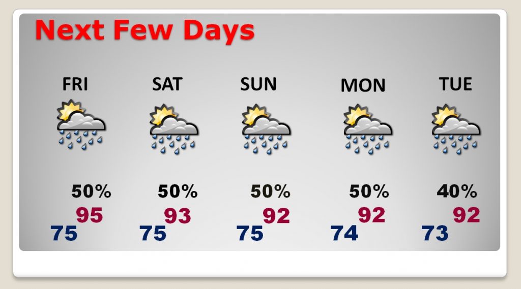
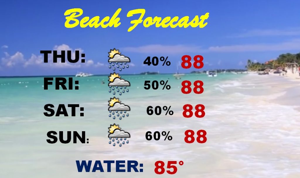
The weekend at the Beach is not a washout, at all, but chances that your fun will be interrupted from time to time are in the 60% range Saturday and Sunday.