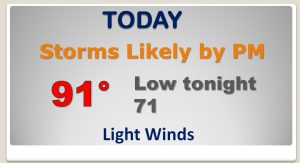
Good morning.. After a wild thunderstorm weekend in Alabama, with dozens of warnings, and hail as large as tennis balls and even baseballs.. (and even 1 tornado)… Today, the severe weather threat is gone, but still, we have a very turbulent atmosphere in place. That will lead to a wealth of showers and storms for about the next three days. I’ll break down the trends and the details for the week ahead. I’ll show you future radar. We’ll look into the tropics, too, on your Monday morning personal weather briefing.
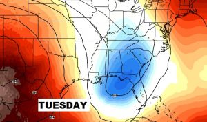
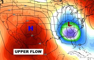
Very unusual upper air pattern for the month of July, which has been the catalyst for the stormy weekend and the better than normal rain chance today and next few days. Storms will be numerous today, but the storms should stay below severe limits.
Higher than normal rain chance continues through Wednesday, but storms thin out a bit by late week and the weekend.
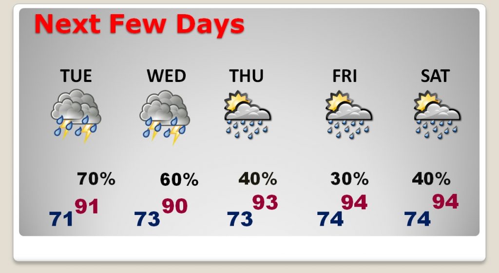
Highs near 90 through mid week, then look for highs to edge back up to the low to mid 90’s by late week.
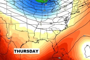
The very strange upper air pattern for July continues tomorrow, as the deep trough aloft leads to numerous storms again. But, the pattern starts to flatten out by Thursday and Friday, which will lead to storms thinning out a bit in number.