Good Morning! Many cities and towns were drenched yesterday. Still, though, some towns especially in east Alabama got skipped. Today or tomorrow could be your day. In fact, the chances get even better Thursday. On this video I’ll run down your rain chance through the end of the week and we’ll look ahead to fewer storms over the weekend. Could the 90’s be back? And, I have an update from the tropics, as well, on your Tuesday morning personal weather briefing.
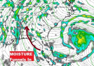
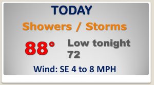
Gulf moisture continues to funnel into Alabama. The stage is set for yet another days of widespread showers and storms. Today could be your day!
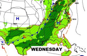
An approaching frontal system will enhance the rain chance for Wednesday and especially Thursday.
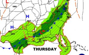
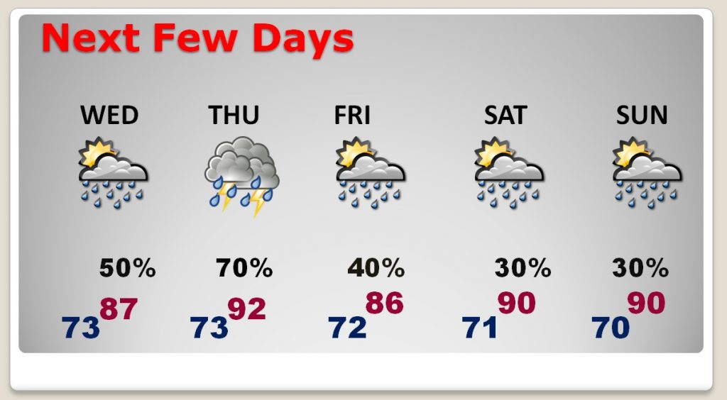
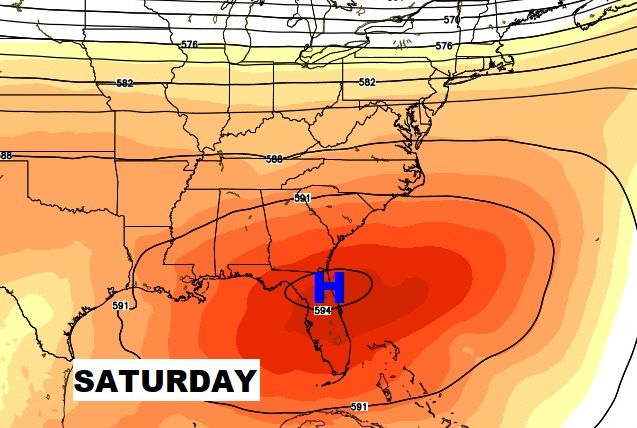
The better than normal rain chance will stick around through at least Thursday. Then, Friday through Sunday the rain chances start to thin out in number, as upper level high pressure builds westward into the area. Highs will be near or above 90 by the weekend.
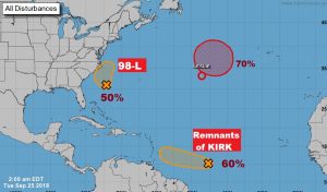
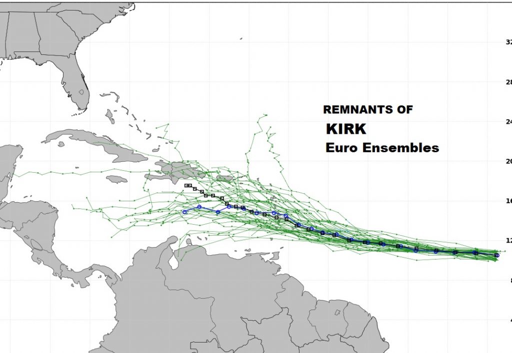
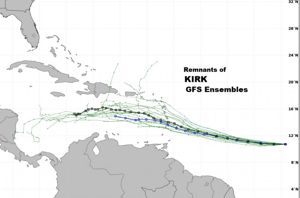
In the tropics, Invest 98-L could tease the eastern seaboard. KIRK is now a post tropical Remnant Low, but still has a 60% chance to regenerate, according to NHC. The global models take this thing into through the Caribbean next several days. If it survives, could it potentially be a problem 6-10 days down the road in this part of the world? Don’t know. We’ll see.