Good Morning! We are monitoring a Severe Weather Risk today, which has been expanded and now covers a big chunk of the state. Damaging Wind Gusts are the main threat, but tornadoes can’t be ruled out. I have the latest on timing and the updated threat level map, plus Future Radar. After the storm system, get ready for not only a nice weekend, but a great string of days ahead. Could we see our first 90 degree day soon?
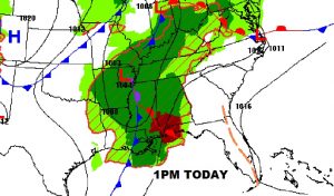
Set up at 1PM. Low near Memphis the Cold front in Mississippi, and the warm front advancing northward.
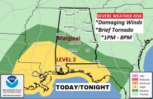
Most of us in a Marginal Severe Risk, as far north as Tuscaloosa, Wetumpka, Union Springs. More Concerning is the Level 2 risk area covering much of southwest and south Alabama. While damaging wind gusts are the main threat, tornadoes can’t be ruled out. Main risk window from 1PM to 8PM.
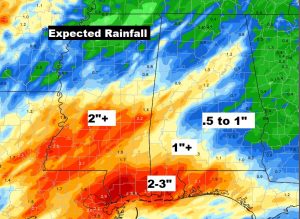
Most of us could see .5 to 1″ rainfall, but much heavier amounts are possible on the coast.
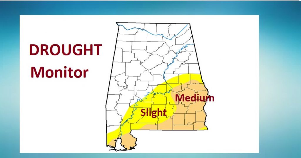
An UPDATED Drought Monitor Map will be issued later this morning.
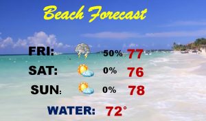
After a tiny threat of showers Friday AM, big improvements mid day and afternoon. Perfect forecast for the weekend and beyond. Could we see our first 90 degree high by Tuesday & Wednesday?
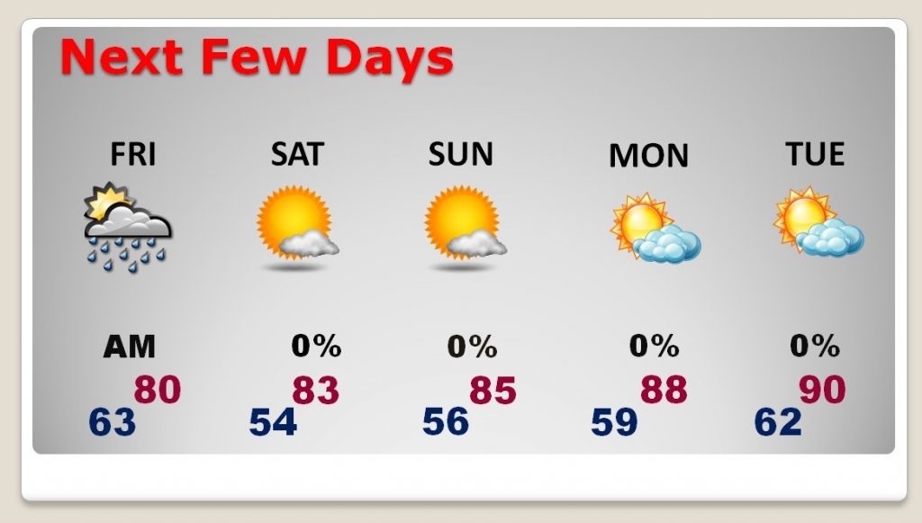
Showers end by mid day Friday, leading to a nice Beach Weekend..