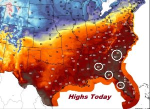
Good Morning! Looks like the record high of 94 is safe today, but there’s a decent chance some of us will see 90 degrees for the first time today, on the last day of April. (That’s roughly 6 weeks early) On this video, I’ll update the chances of seeing some showers later in the week, as frontal system approaches by late week. Your weekend plans could be affected. And, what about projected rainfall amounts? It may be time to get out the garden hose soon.
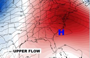
The big upper high over the southeast will continue to act as a dome, keeping storm systems at bay, while the warming trend continues. If we get to 90 degrees for the first time today, it’ll be roughly 6 weeks too early, based on averages.
Rain chances will get better on Friday through Saturday and Saturday night as a front approaches. The showers and thunderstorms will be scattered in nature.
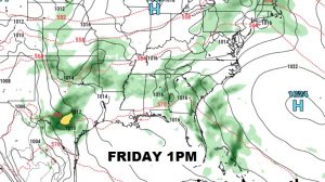
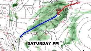
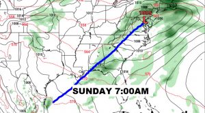
Isolated pop up showers are possible Wednesday and Thursday afternoon. Rain chances will get better on Friday through Saturday and Saturday night as a front approaches. Highs in the 80’s continue.
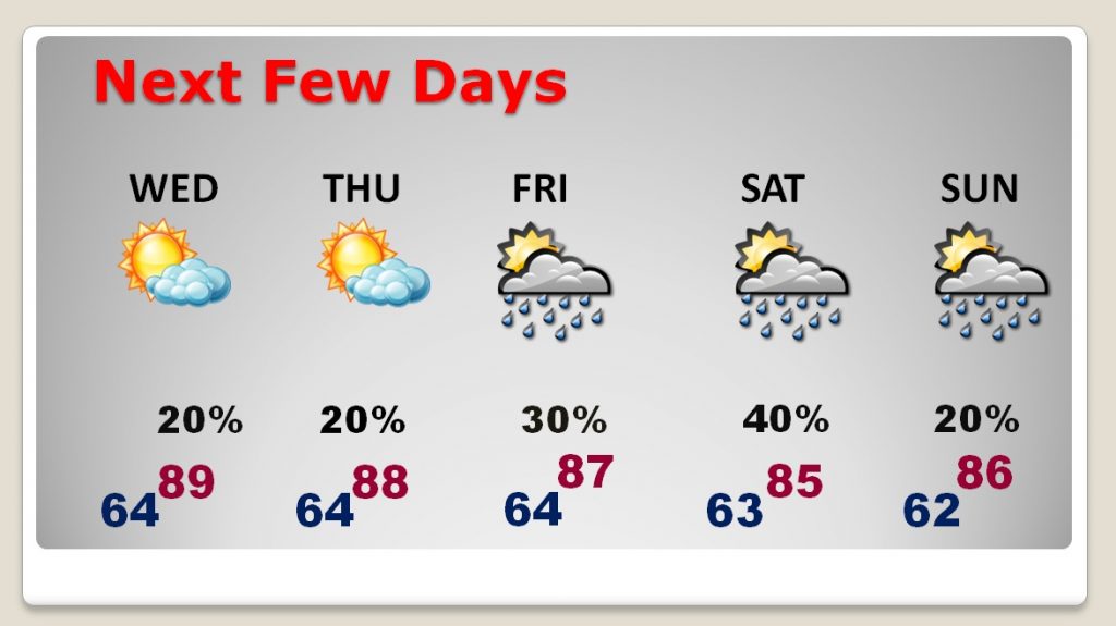
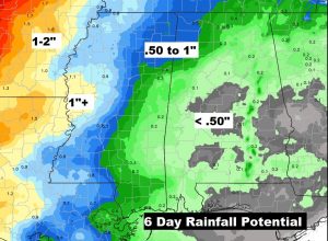
Total expected rainfall totals through Monday is not looking promising. We need the rain.