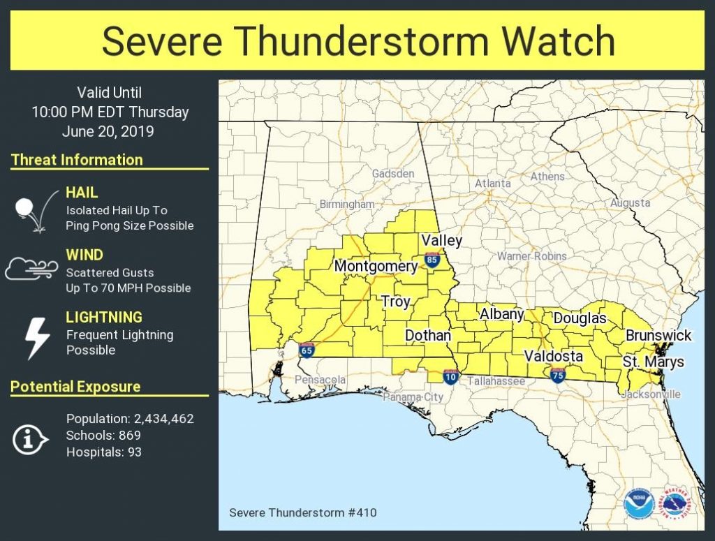
SEVERE THUNDERSTORM WATCH (1:00PM 6/20/19)
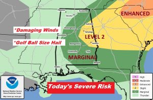
The Storm Prediction Center has issued a Severe thunderstorm Watch for most of south and central Alabama until 9PM. Damaging wind gusts to 70 mph and perhaps large hail up to Golfball size are possible.
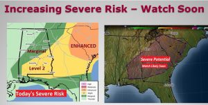
11:30AM UPDATE: The Storm Prediction Center has upgraded to a Level 2 Severe Risk across south and part of central and eastern Alabama. Also, a Severe t’storm Watch is likely soon from central & SE Alabama to South Carolina. Large Hail and damaging wind gusts are the main threat. #alwx
EARLY MORNING UPDATE AND VIDEO:
Good Morning! Today’s atmosphere is a little volatile, and the stage is set for a few strong to severe storms this afternoon, with damaging winds & large hail possible in the stronger storms. I have the latest Future Radar, and the updated threat level from the Storm Prediction Center. Get ready for some intense weekend heat, on the first official weekend of summer. Will there be any cooling showers? And, and I have a sizzling hot Beach Forecast, on your Thursday morning personal weather briefing.
Storms redevelop this afternoon. A few Storms could be severe with damaging wind gusts and golfball size hail is possible. Stronger risk exists in the eastern counties.
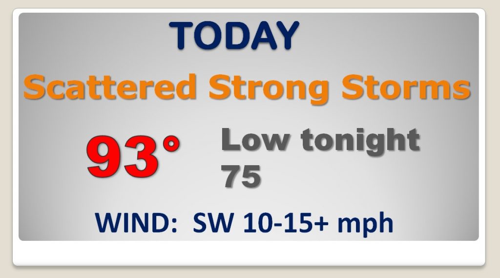
Today’s high of 93 will be fuel for the fire for the afternoon strong storms. Very humid.
Sizzling hot first weekend in Summer with mid 90’s and dangerous heat index levels. Storms thin out.
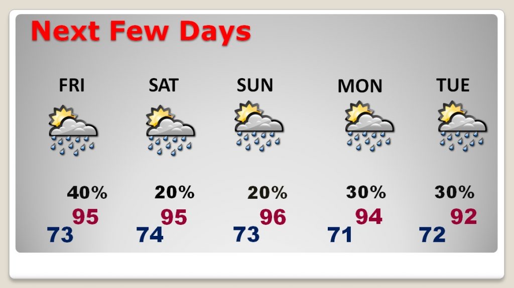
Dangerous triple digit heat index levels Friday through Sunday
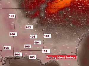
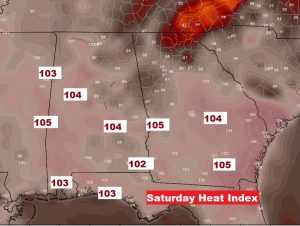
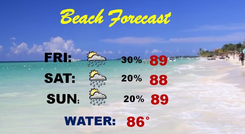
Even at the Beach this weekend, the heat index will be 100+. That sand will be HOT HOT.
Summer begins tomorrow.