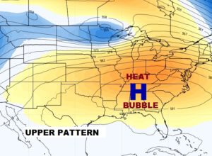
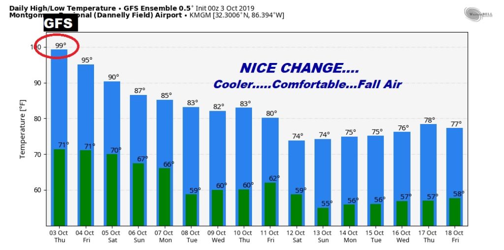
Hang on! We’re still under the big Heat Bubble today and tomorrow. More record high temperatures. But, Cool Fall Air Relief is on the way. We’ll be much cooler next week. A cold front will move through the state Monday. BUT, will that front bring much needed raindrops to the state? I have an update on the rainfall potential. Meanwhile, our Drought continues to get worse. New Drought Monitor map will come out today. I have updated your forecast for the first weekend of the fair.
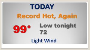
RECORD breaking heat again today. The record is 94 from 1959. Rain chance is NOT zero today, but under 20%. There will be a couple of showers on radar.
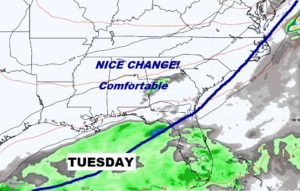
Rain chances under 20% through Saturday, 20% Sunday. Scattered showers and maybe a thunderstorm Monday with the front (we hope), then much nicer Fall air on Tuesday.
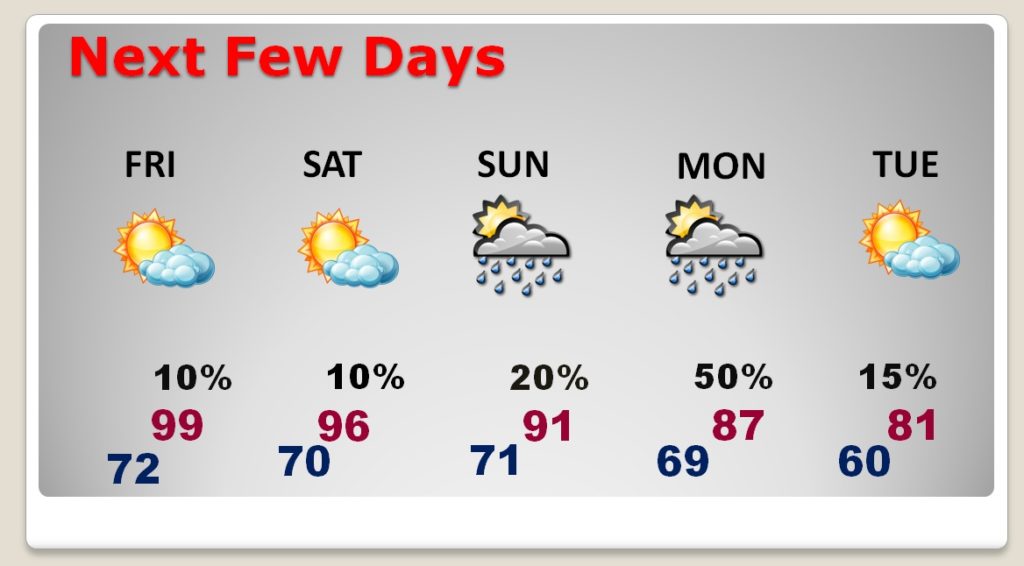
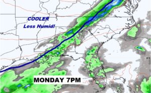
Impornant Cold Front moves through the state Monday with a band of showers ahead of it, and much cooler, really nice air behind it.
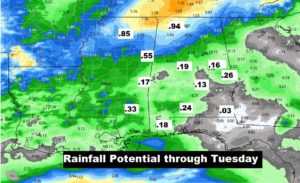
Will that cold front deliver much need rain to our area. Maybe not much. The models show some disappointing totals.
Look for some NICE air next week, especially Tuesday and beyond…with much cooler, comfortable days, and pleasantly cool nights which will finally feel like Fall.
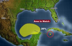
NHC still monitoring the SW Gulf of Mexico for possible future development. Tis the season to watch that area. Tomorrow is the anniversary of Opal in 1995.