Good Morning! Today will be another care-free, and very comfortable day. But changes are approaching. A storm system will swing through the state Wednesday, and there will be another storm system over the weekend. If you are traveling to other states, especially north of us, be ready for travel delays. Airport delays will common, coast to coast, because of the ripple effect, as the storms cause delays at major hubs. On this video, I’ll bring you up to date on the timeline, which has changed. Will there be any severe weather? What about Iron bowl weekend?
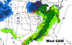
While we will be comfortable and dry today, we note the significant storm system that will be moving across the mid section of our nation with heavy snow from the Midwest to the Great Lakes, and showers and locally severe storms in the warm air sector ahead of the front.
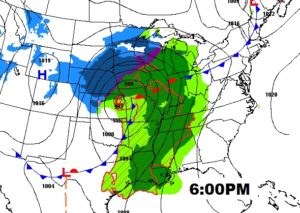
Attention Travelers…this storm system will have snow and ice in the cold air sector and severe thunderstorms, including a tornado threat in the Nation’s heartland today.

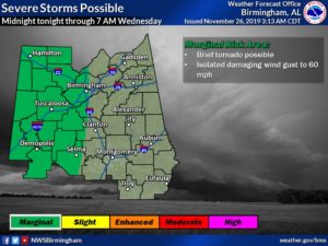
The local NWS office has included the western counties in a Marginal Severe Risk from Midnight to 7AM Wednesday, along and west of a Birmingham/Selma line. Damaging wind gusts are possible, and a brief tornado can’t be ruled out.
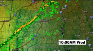
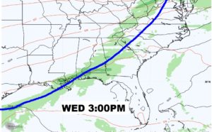
The front marches across the state tomorrow with a band of showers and storms ahead of it. Meanwhile a large part of the nation will be effected by this storm system from the Midwest and Great Lakes to the northeast.
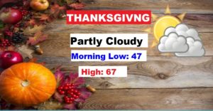
Timing is everything, and it still appears the Thanksgiving forecast will be nice.
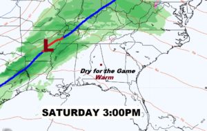
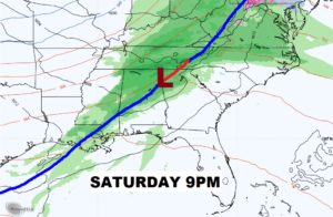
Black Friday will also be dry and comfortable. But Storm System #2 arrives this weekend. Showers and storms by Saturday night into Sunday. Possibly severe? We don’t know yet.
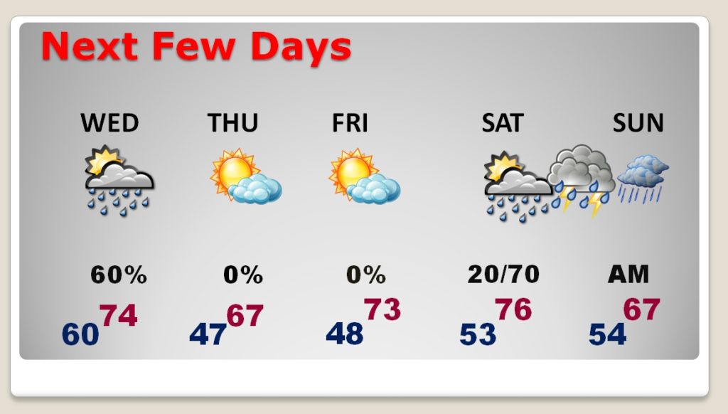
Right now, I think we should be dry in Auburn for the Iron Bowl, with a 2:30 kickoff. Temperatures should reach the 70’s The storms arrive Saturday night.