If you got a minute to watch a quick 1 minute 46 second video chat…here’s an update on tomorrow’s severe weather threat. NOT Much has Changed from this morning as far as expectations.
CLICK ON THIS QUICK VIDEO CHAT!!!
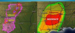
Our to the west of us…this afternoon: Looks like it could be a day in April, huh? But, it’s January 10th. Numerous tornado warnings and couple of Tornado watches, Oklahoma and Texas. Farther east a significant Level 4 Moderate Severe Risk for the ArkLaTex. This is Alabama’s future tomorrow. Monitoring..
EARLY MORNING UPDATE:
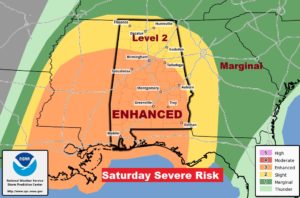
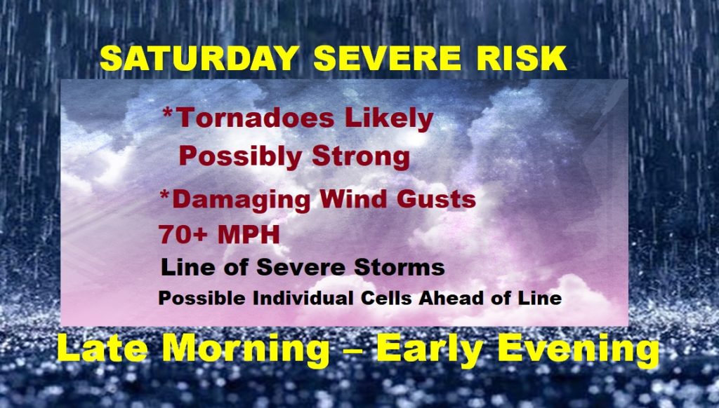
It’s rare in the month of January to see such a STRONG Severe Weather Threat. Saturday’s ENHANCED Risk is level 3 out of 5. It’s not out of the question that the risk could be bumped up to Level 4 before the storm system arrives. Tornadoes are likely in Alabama tomorrow. A few could be strong, EF-2 or higher. Damaging wind gusts 70+ mph are also good bet with many of the storms. The action could begin late morning west, spreading eastward through the day and exiting the eastern counties later in the evening. I have the very latest information on this developing situation on this video, as we continue to prepare for this potentially significant severe weather event. Have a family plan. Stay weather aware.
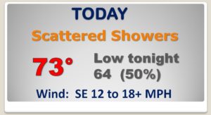
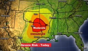
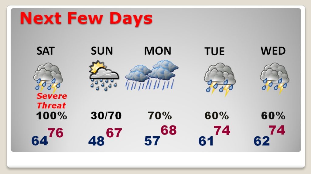
Nothing severe here today. Scattered showers today and tonight. Maybe a thunderstorm. Look at the map! There’s that big storm system lurking out to the west of us.
Could be a major outbreak of tornadoes across the ArkLaTex Region today. RARE Moderate Risk. Level 4.
PRIME TIME LINE from about 10AM in the far west to 8PM in east and SE Alabama. TORNADOES are likely. A few Strong. Damaging wind gusts to 70+ mph. The ENHANCED Level 3 risk could possibly be upgraded to Level 4 before this event begins.
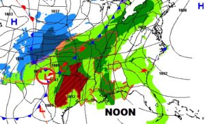
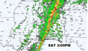
Just to give you a taste of Future Radar, here’s one snapshot around 3PM, showing the squall line in central Alabama and individual cells, possibly rotating ahead of the main line.
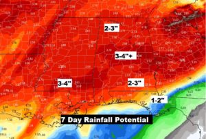
On and off rain is in the forecast for the next few days..
Series of disturbances in the next 7 days could produce locally heavy rainfall amounts in spots.