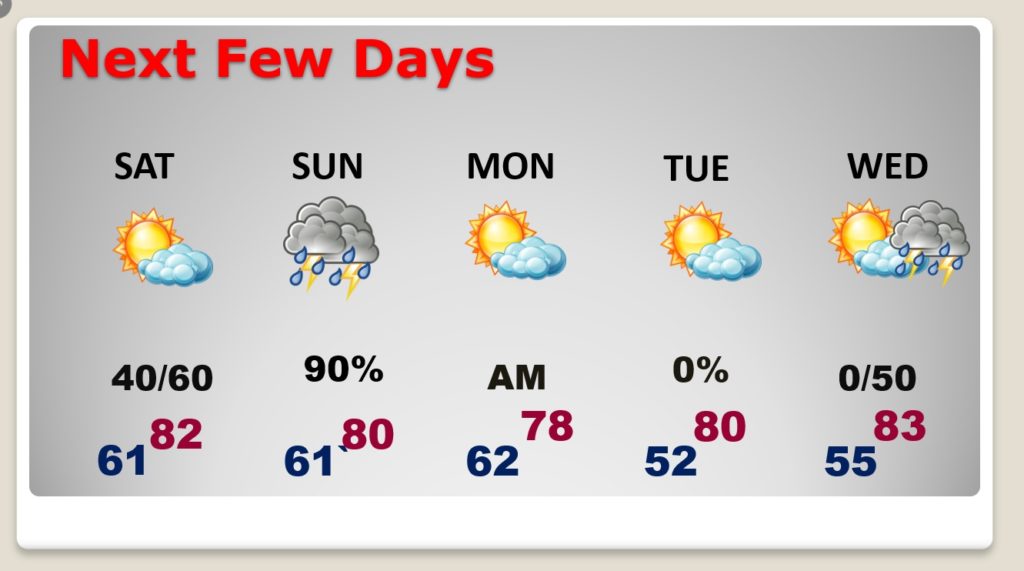
Good Morning! Enjoy what should be a simply beautiful Friday. Changes are on the way. Scattered showers will be around Saturday and Saturday night. And, the stage is set for another dose of Severe Weather Sunday, especially by Sunday evening and Sunday night. In fact, looking ahead, we may have yet yet another round of severe weather by the middle of next week. On this video, I’ll bring you up to date on the updated timeline and the latest threat level from the Storm Prediction Center. April is the height of the Severe Weather Season here in Dixie Alley. It looks like a bumpy ride ahead for the next few days.
Enjoy this nice quiet, tranquil, warmer Friday…
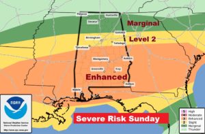
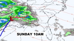
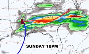
Another Sunday Severe Weather Threat. The Enhanced Risk area covers all of central Alabama. That’s where the greatest tornado risk will exist. Greatest threat begins Sunday afternoon and continues Sunday night.
This is not nearly the potent set-up we had Easter Sunday…HOWEVER, this situation needs to be treated with great respect.
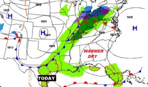
Scattered showers return Saturday. Showers and locally severe storms Sunday. Nice Tuesday. Highs 80+ each day. More severe weather by next Wednesday night.
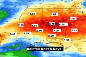
There is a swath through central Alabama which could possibly see some locally heavy rainfall amounts through Monday. Perhaps 3 to 4″+.
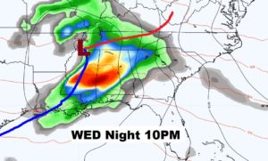
This looks quite concerning to be. Developing Severe Weather threat which needs to be closely monitored. I do not like this set-up.