11:30 AM UPDATE:
EARLY MORNING UPDATE:
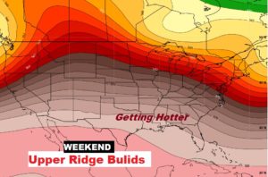
Get ready for a big change. A cool front will sweep through Alabama today. A band of strong to severe storms will precede the front. Damaging wind gusts are the main threat. The risk begins this morning, and exits the state by early evening. Much cooler air sweeps in behind the front for Thursday and Thursday night. But, the big cool-down will not last long. How about an early sample of summer heat over the weekend? It will feel like June. I’ll update the details of another storm-free weekend. And, we’ll look ahead deep into the month of May. There’s evidence of another big cool-down ahead.
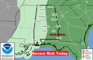
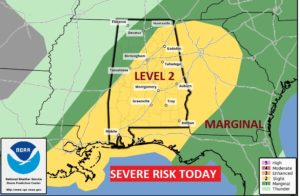
Strong cold front will bring a band of strong to severe storms into the state today, then much cooler tomorrow.
LEVEL 2 Severe Risk today. MAIN threat is damaging wind gusts. The tornado threat is small but not zero.
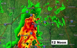
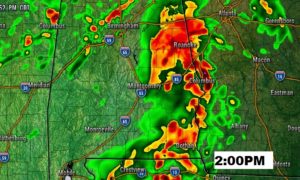
Strong storms begin this morning and spread across the state through mid-day and well into the afternoon.
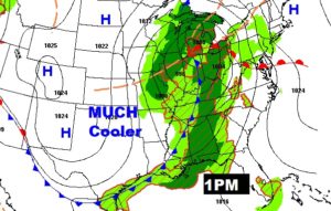
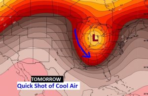
A quick shot of much cooler air funnels into the state Thursday and Thursday night.
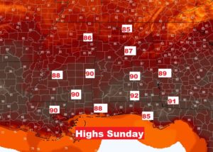
CHILLY Friday morning, but quick warming Friday and Saturday. Teasing 90 degrees Sunday and Monday.
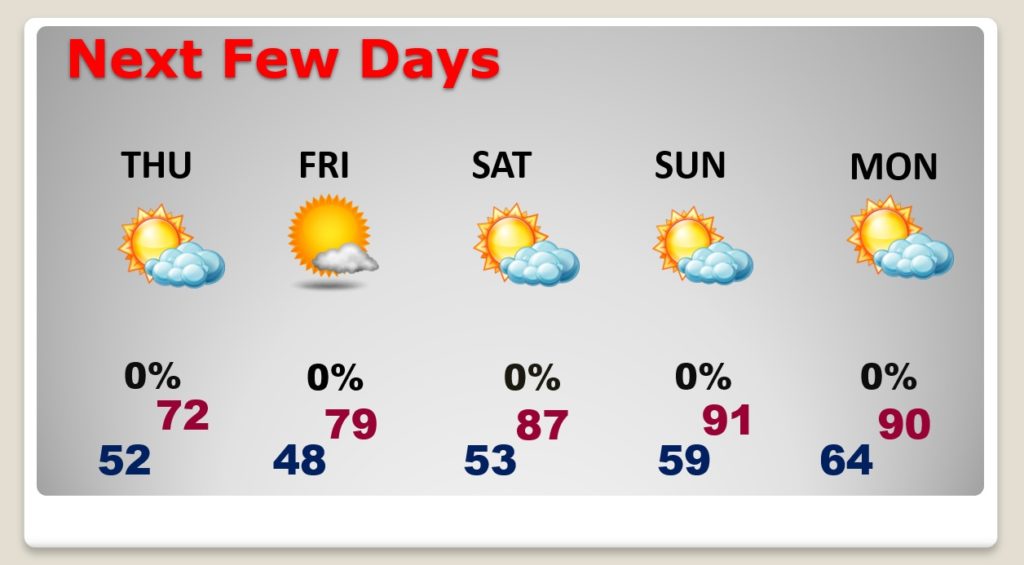
Summer preview this weekend.