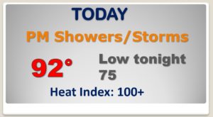
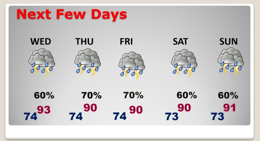
Good Morning! On this last day of June, expect another nearly intolerable hot & humid day with triple digit heat indices. Yesterday we had a high of 94 with a heat index of 104. There’s no reason to believe we won’t be in the same neighborhood today. We’re getting into a very unsettled pattern. Thunderstorms will become much more numerous over the next several days. Unfortunately, the stormy pattern, with better than normal rain chances will be with us through the 4th of July holiday weekend. I have “tweaked” the rainfall probabilities through Monday. I’ll show you how much rain could fall, and we’ll check the tropics.
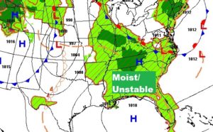
Moist, unstable atmosphere with dewpoints in the mid 70’s…added with intense heat will lead to big storms.. Feast or famine.
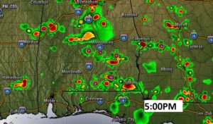
Radar should be much more active today than yesterday.
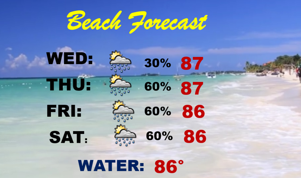
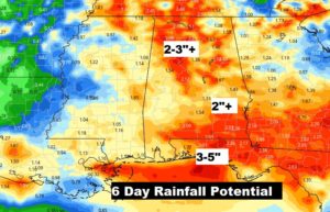
Unfortunately, Beach goers will have to dodge some storms and downpours through the holiday weekend. Total rainfall in spots could total 3-5″.
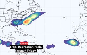
In the TROPICS, NHC is monitoring an “area to watch” off the North Carolina coast. Another wave coming off Africa needs to be watched, too, over the next few days.