
8AM UPDATE:
Good morning! Our weekend weather will be relatively routine, with slightly better chances than recent days. But, the week ahead looks active. The daily rain chance will dramatically increase. The best news is that the intense heat will ease a bit through mid-week. By, late next week, it’s back to business as usual as the number of storms “thin out” and the heat returns.
Meanwhile, the tropics are very active. South Texas is getting ready for a visit from what will soon be Hurricane Hanna. Details below.
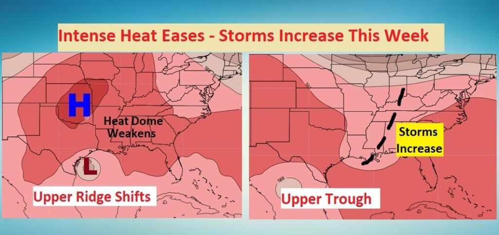
The Upper Heat Dome over us will weaken, as a trough develops. This will increase the number of storms and ease the heat this week.
TODAY: Partial sunshine. High 93. There will be a generous supply of those random scattered afternoon and evening storms. Low tonight mid 70’s.
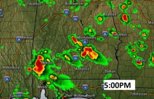
Here’s a Future Radar snapshot showing the general storm coverage at 5PM.
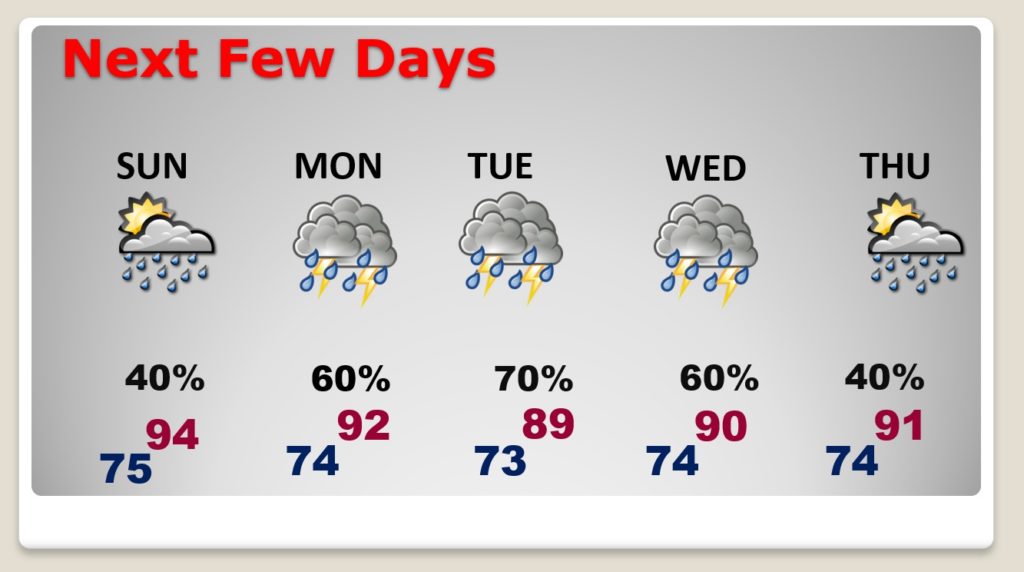
NEXT FEW DAYS: Rain chances get better and better. Showers and storms will be likely Monday through Wednesday. That’ll hold the temperature down a bit. Rain chances will decrease late in the week as the temperatures rise.
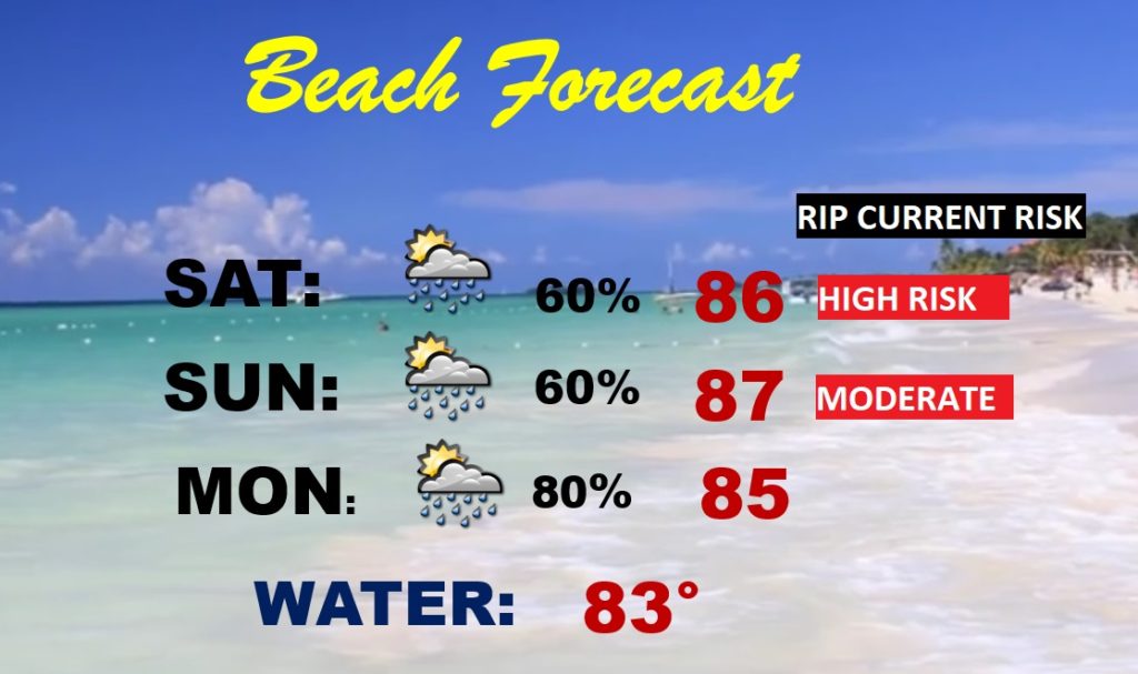
BEACH FORECAST: High rip current risk today, and moderate on Sunday. Scattered to numerous showers and thunderstorms. Thunderstorms become likely Monday.
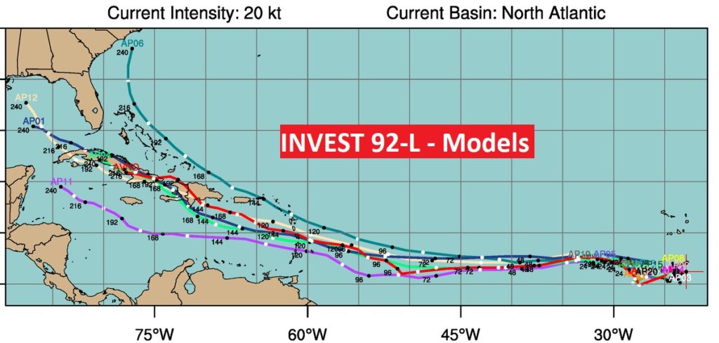
TROPICS: Very busy in the tropics with Hanna approaching south Texas, Gonzalo approaching the Windward Islands and an increasing chance that Invest 92-L will develop into a Depression or storm in a few days.
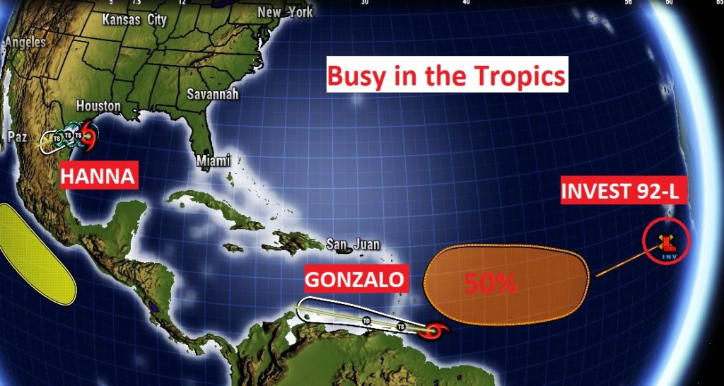
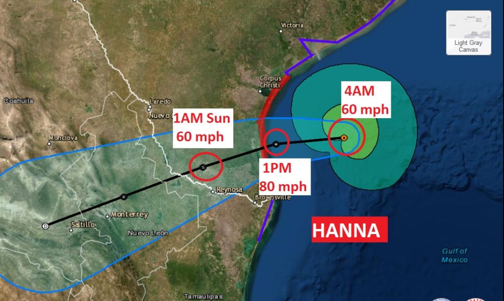
Hanna is close to hurricane strength as it heads for south Texas today. It could be an 80 mph hurricane at landfall. Lots of heavy rain for Texas.
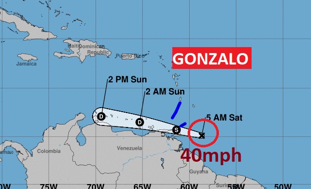
Gonzalo is falling apart and is barely a tropical storm with 40 mph winds as it approaches the southern Windward Islands. It will continue to fizzle.
Invest 92-L could become a depression or the next Tropical Storm. NHC currently gives it a 50% chance of development.
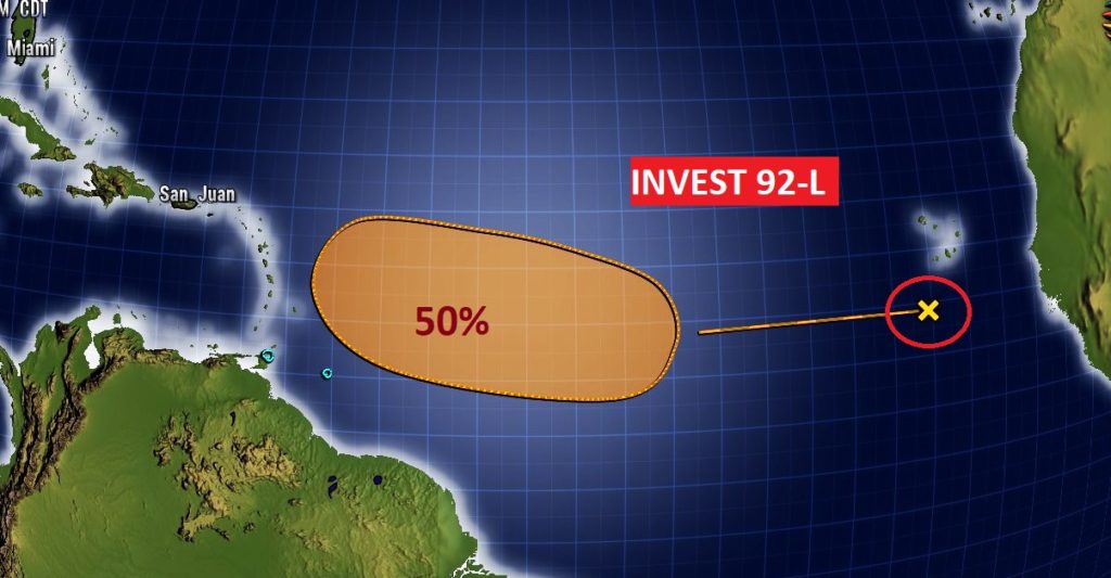
Could this system eventually have implications the Gulf of Mexico or the Southeast US? Maybe….
—
I will have another Blog update tomorrow morning. Follow me on Twitter: @RichThomasWX. Stay safe and well.
-Rich