
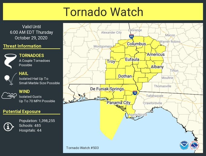
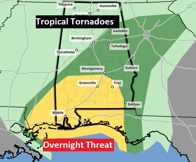
NEW Tornado Watch until 5AM covering east Alabama. Mainly from Macon, Bullock, and Pike, Covington counties eastward.
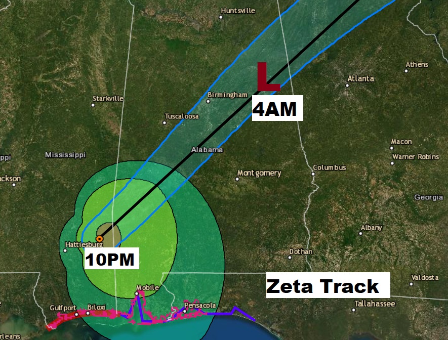
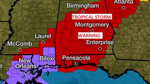
ZETA, still a 75 mph Cat 1 Hurricane, at 10PM was located very near the AL/MS line, moving rapidly NE at 31 MPH. It will cross the state quickly overnight. Tropical Storm Warnings continue. This will be a widespread severe wind event, especially in the wee hours of the morning.
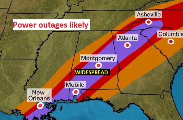
ZETA’S EXPECTED IMPACTS: I can’t emphasize enough, I expect power failures could be widespread through the heart of Alabama, as LARGE trees and powerlines come down overnight. Roads will be blocked. The Thursday morning commute could be rather difficult, indeed. Be ready for the loss of power.
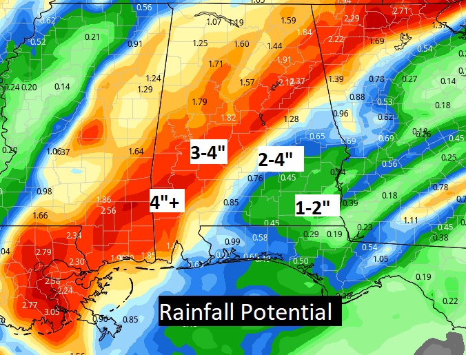
In addition, locally heavy rain could easily total 2-4” in only a few hours, causing local flooding. And, the tropical tornado threat will continue along and to the east of Zeta’s exact track.
The tropical tornado threat will continue through much of the night along and to the east of Zeta’s track.
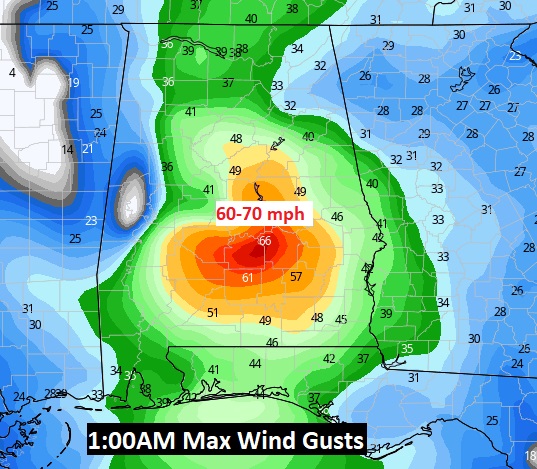
The wind field will be intense. Look at one model idea of what the maximum wind gusts could be around 1AM. The early morning hours could be pretty rough. Particularly Midnight to 4AM. Big improvements after sunrise, as the winds come down dramatically.
FLOODING could also being experienced in spots along Zeta’s path. The Good news is, the storm is moving so quickly to the northeast.
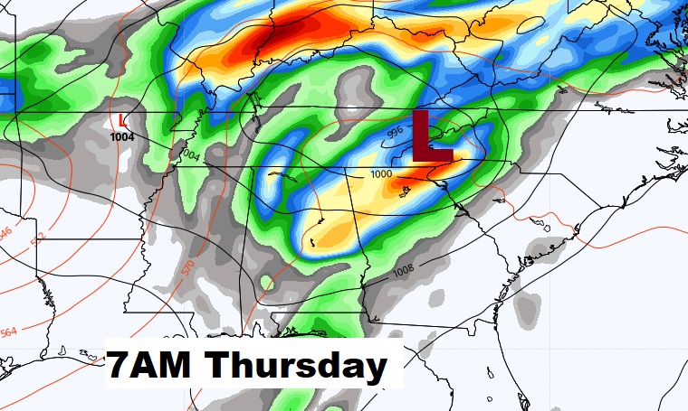
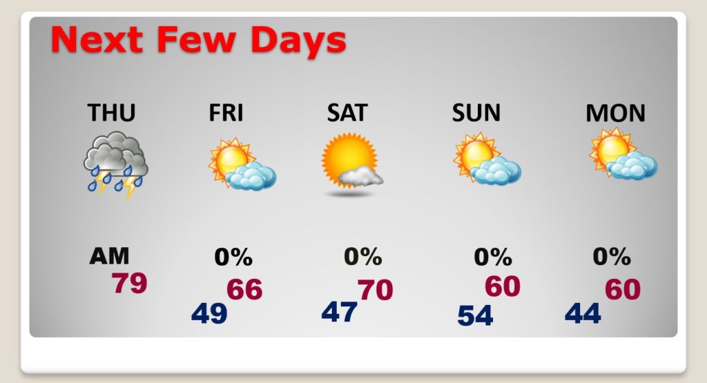
BIG improvements will begin after sunrise. ZETA will have long left Alabama. Tropical rain will continue in the morning, but will taper off by mid Day.
We could even see partial clearing this afternoon. Mostly clear and chilly tonight. And, we are just expecting a beautiful Halloween weekend behind Zeta.
Stay Weather safe tonight! I’ll keep you updated on our Weather App on Social Media, plus we’ll be broadcasting LIVE on the Bluewater Radio stations including WBAM 98.9 and WACV 93.1.
–Rich