Good Morning! We are in for a couple of really nice late December days before a vigorous New Year’s Eve storm system arrives. Our morning chill today will fade quickly. We’ll be well into the 60’s today through Wednesday. The Thursday storm system needs to be watched. It could bring round of Severe Weather to Alabama and the Gulf south. On this video, I’ll brin you up to date on the timeline and we’ll look ahead to the New Years Weekend forecast, which looks cooler but nice.
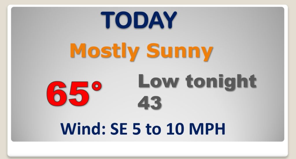
Weak front will have little or no effect on our weather today. Nice way. Warming trend continues. Not as cold tonight.
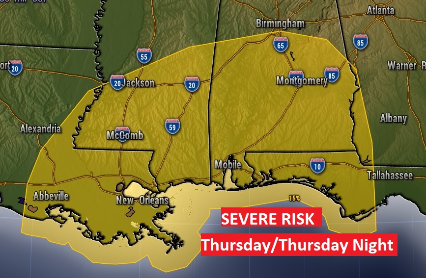
NICE Tuesday and dry and mild Wednesday. Showers and storms Thursday, Thursday night, ending Friday morning.
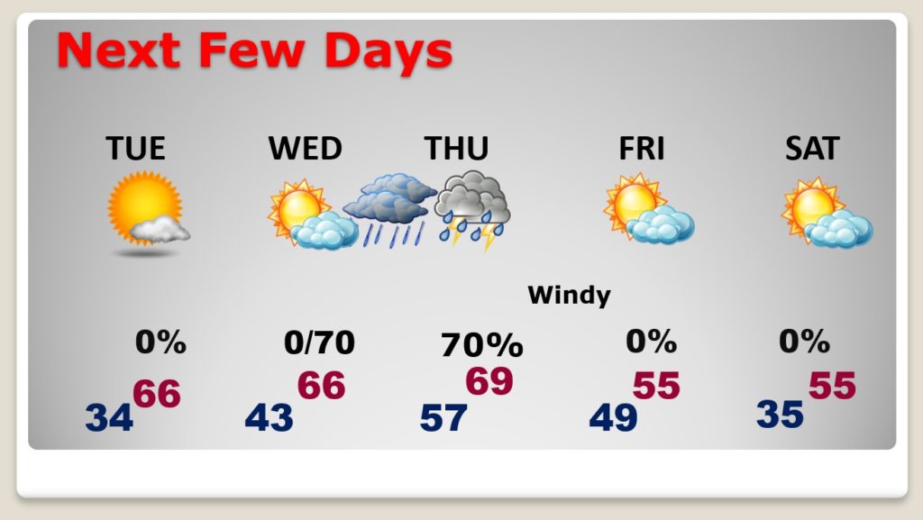
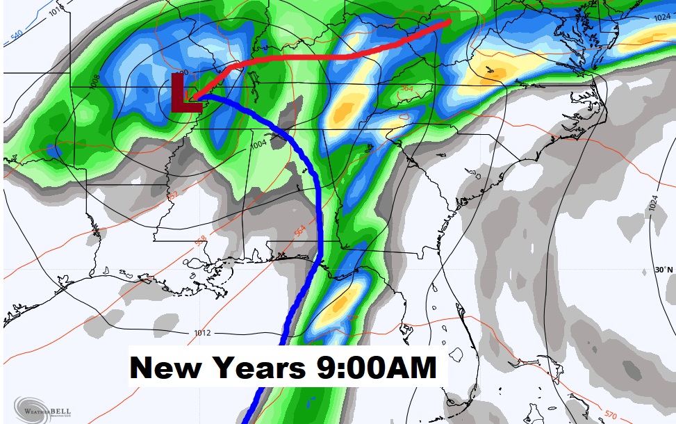
Potent New Year’s Eve storm system. Showers and storms Thursday, Thursday night, ending Friday morning. Possible Severe Weather situation. Cooler behind the storm system but no Arctic air this time.
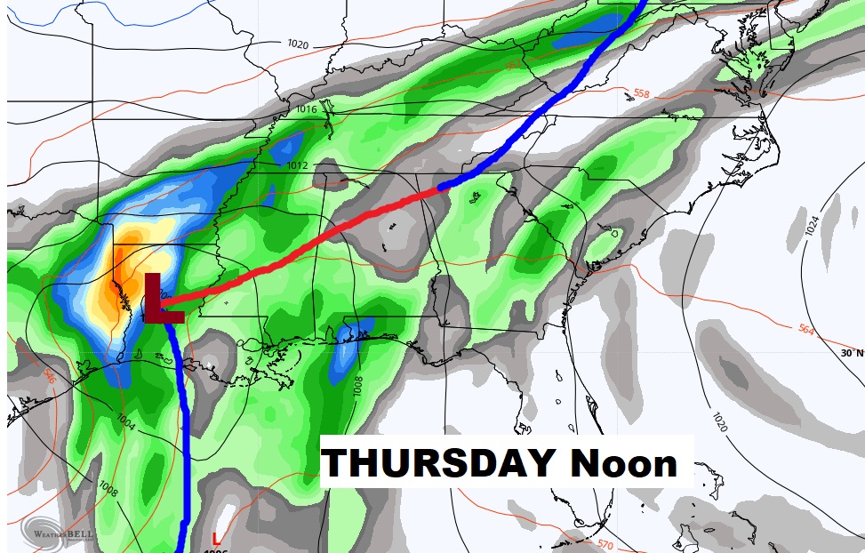
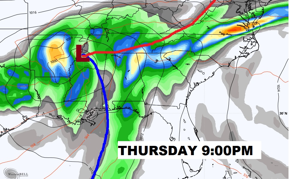
This storm system could bring a significant severe weather threat to the state by Thursday afternoon or more likely Thursday night, including the threat for tornadoes.
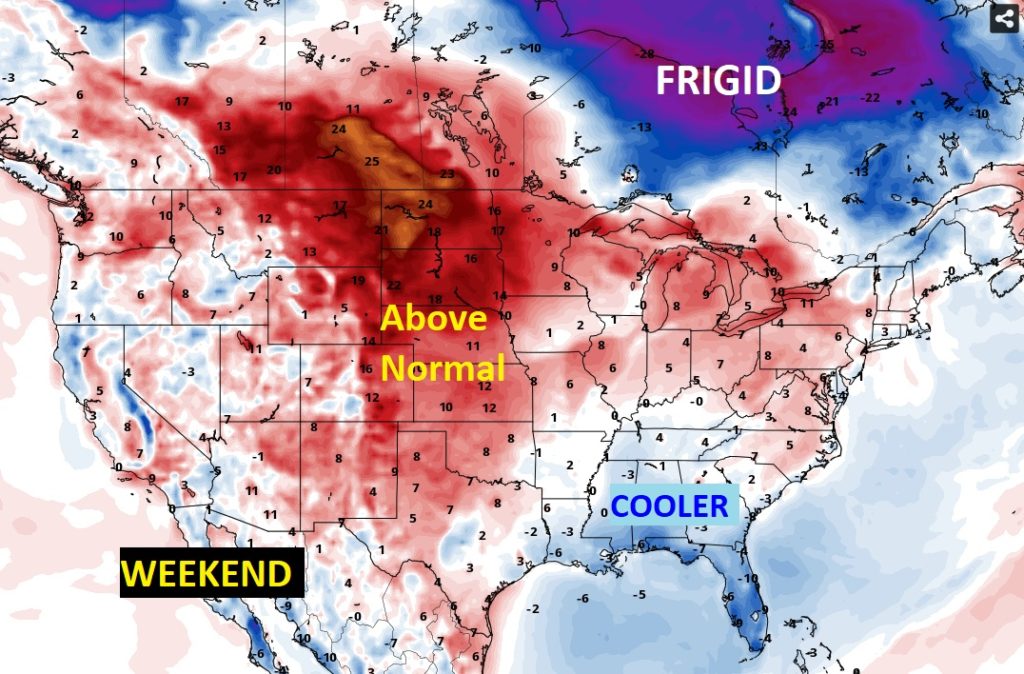
Cooler behind the storm system but no Arctic air this time. The FRIGID air stays locked up in Canada where it belongs.