
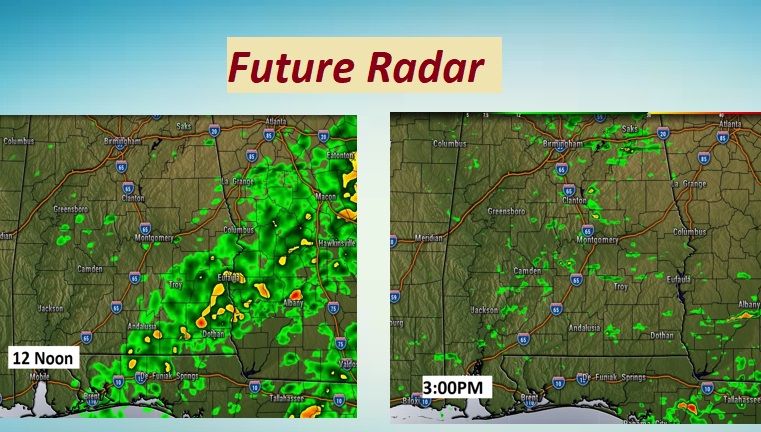
Good Morning! Weather changes are underway. Bands of showers are moving across the state. The main rain band will exit Alabama by early afternoon. A cold front will sweep through this afternoon.
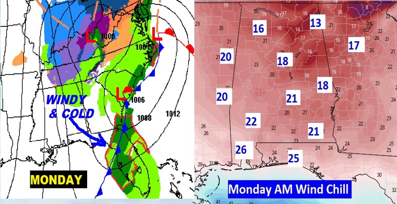
Get ready. Much colder air will overspread the area tonight and Monday. By Monday morning wind chills in the teens and 20’s will be common. It will be yet another shock to the system.
Temperatures will moderate by late week, just in time for the next storm system by Friday. There’s evidence of another Arctic Plunge about a week away. Welcome to the realities of February.
TODAY: Periods of showers will dominate this morning. Mild. High today 71. Although the main rain band should exit by about lunchtime, it’s possible that a few isolated showers will accompany the front this afternoon. Windy and colder tonight. Low 39. Wind chill will be a factor.
Here’s a couple of Future Radar snapshots.
MONDAY: The brand-new month of February, will be quite Brins & raw. Windy and cold. Morning wind chill factors will be in the teens and 20’s. Dress in layers. Although the afternoon high will be in the 40’s, wind chill, even in the afternoon will be in the 30’s Here’s expected wind chill early tomorrow morning. Ouch.
NEXT FEW DAYS: Freezing temperatures are expected Tuesday and Wednesday morning. We’ll be in the upper 60’s by Thursday & Friday. The next storm system will begin to affect the area Thursday night & Friday.
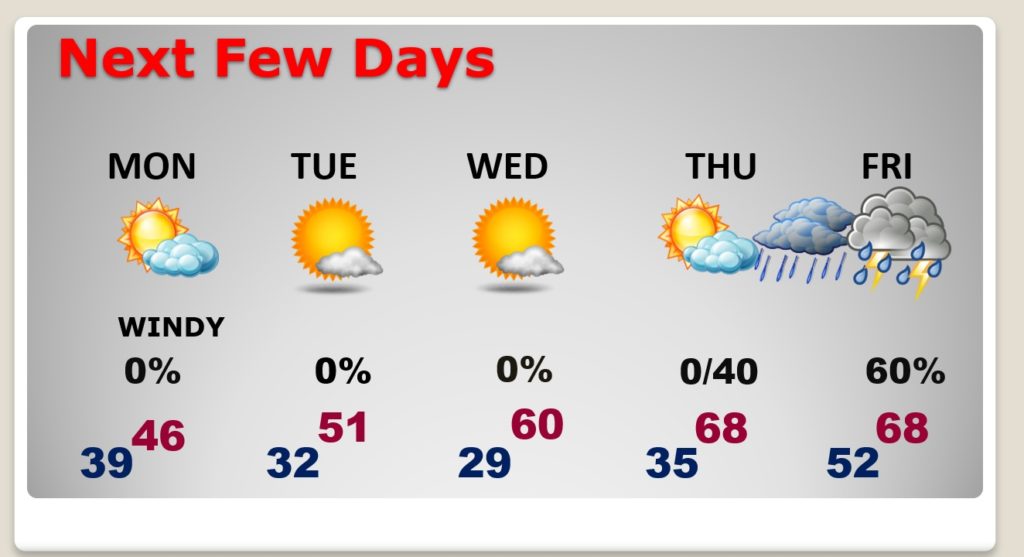
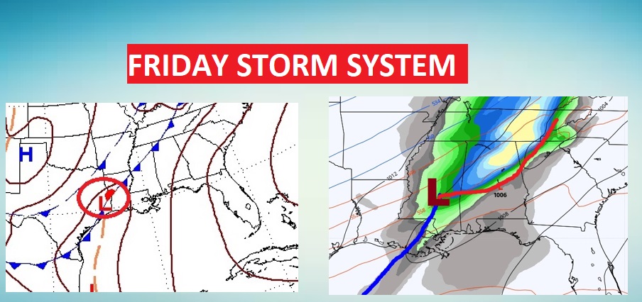
FRIDAY STORM SYSTEM: The models are inconsistent. It’s too early to say whether the Friday storm system will have severe weather component. Stay tuned. We’ll watch later model runs.
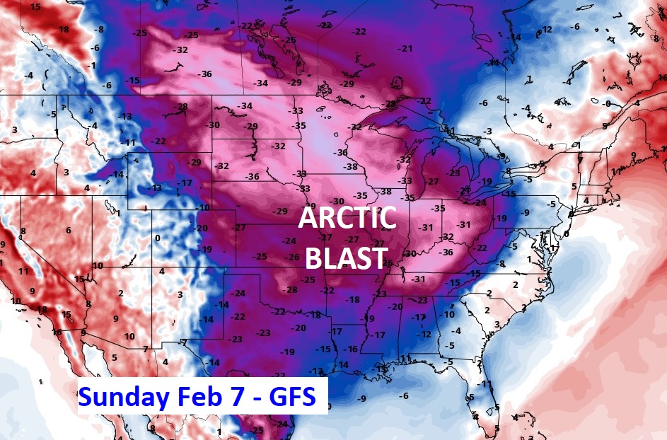
NEXT ARCTIC BLAST?: Could we be only a week away from yet another shot of COLD Arctic air? Some of the models are strongly hinting we are. Here’s some a sample of the GFS temperature anomalies next Sunday, February 7th. Not good. Possibly the coldest of the winter so far.
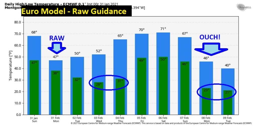
Here’s the Euro raw temperature guidance, showing another huge plunge around February 7th and 8th. The GFS temperature guidance is actually colder. Let’s hope this doesn’t happen. ????
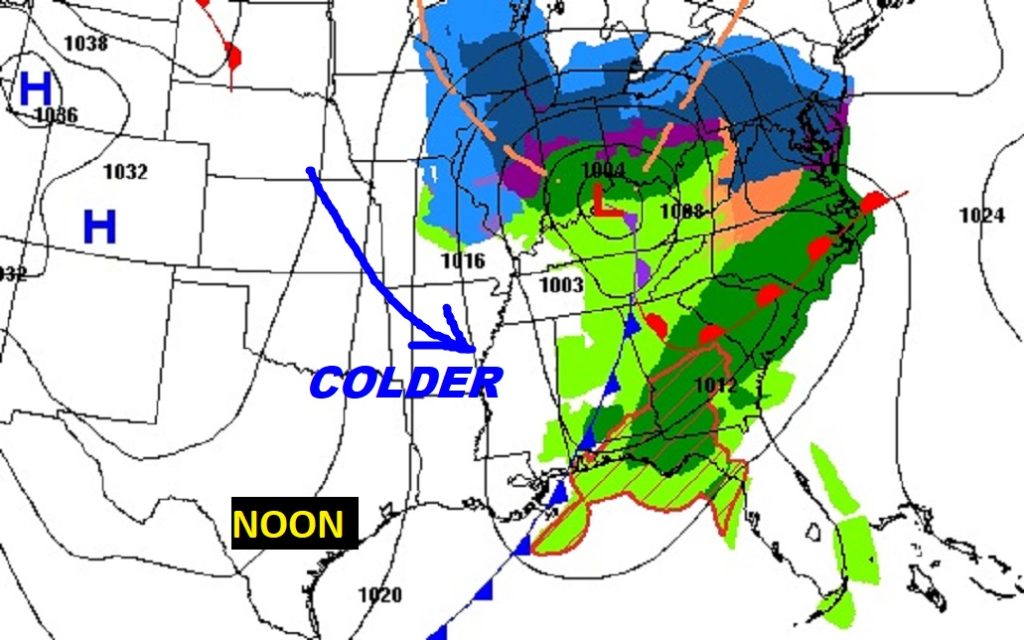
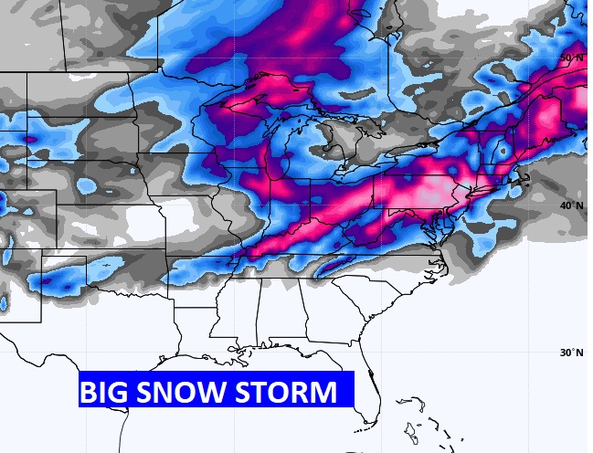
MASSIVE SNOW STORM: The big weather news involves a HUGE storm storm affecting a big chunk of our nation today, tonight and tomorrow from the Midwest through the northeast and middle Atlantic coast. Some places could see 8 to 12″ or MORE. Biggest snowstorm of the season.
I hope you have a nice Sunday. Enjoy the mild temperatures. I’ll have a complete video update in the morning.
–Rich