
Good Morning! It’s still April, but it’s going to feel more and more like summer over the next 2-3 days. And, it looks like our storm-free pattern continues through Thursday. A late week storm system will bring showers and thunderstorms back to the state. There are new question marks about the weekend weather details. The models are not in agreement. I’ll do my best to sort it out for you. And, we’ll look back. Today is the 10th Anniversary of the most tragic weather event in Alabama history and the biggest tornado day in United States history.
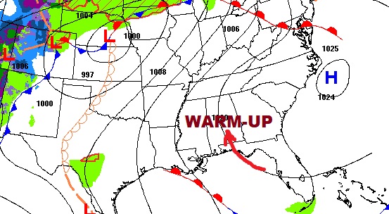
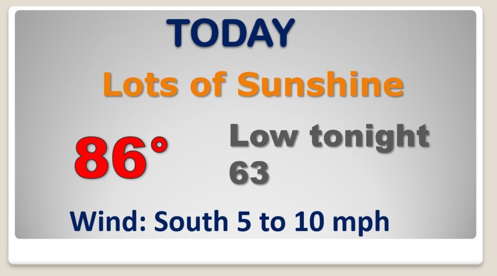
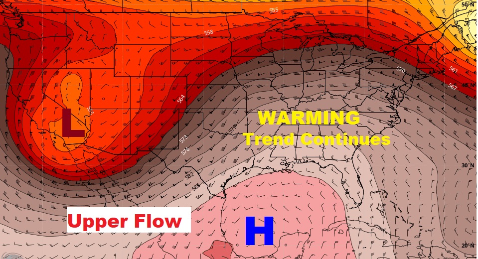
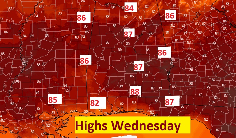
High pressure Ridge in the upper Atmosphere will promote a very warm almost summer-like Wednesday.
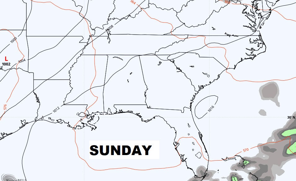
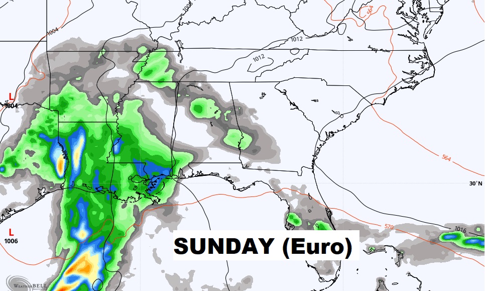
Discrepancies in the weekend forecast. Models don’t agree. For instance, the GFS shows another nice Sunday. Dry. The Euro is much wetter. Same discrepancy for Monday.
Storm-free through Thursday and almost summer-like. Showers and thunderstorms Thursday night into Friday. Question marks about the weekend. Right now I’ll keep the rain chance on the low side.
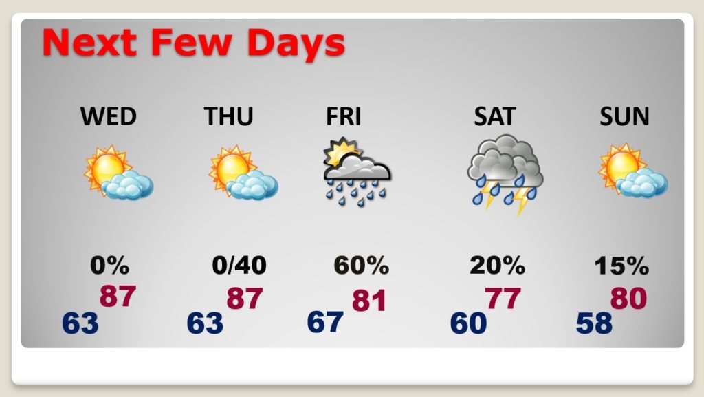
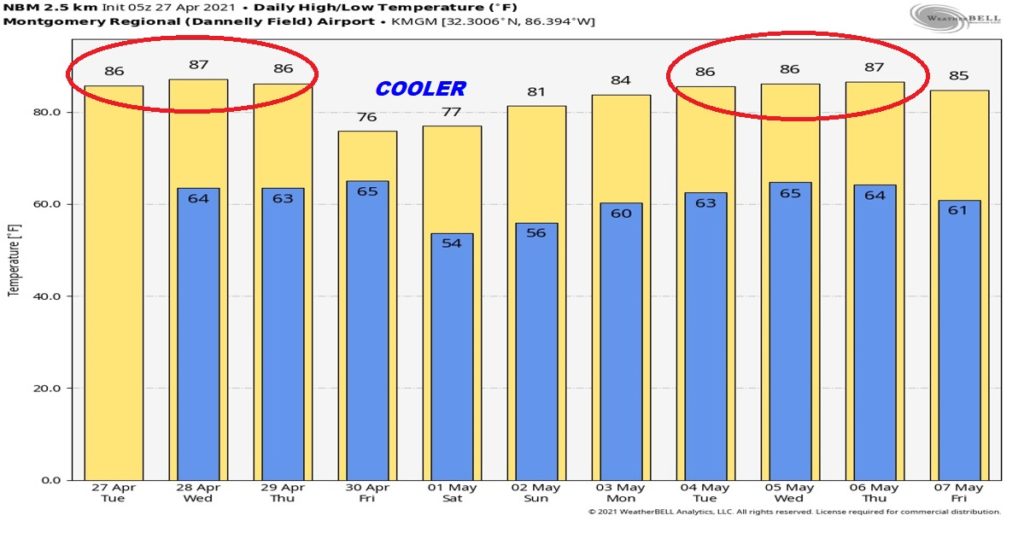
Warm through Thursday. Cooler over the weekend. Another warm-up next week.
This is the 10 year anniversary of the worst weather tragedy in Alabama history, and the biggest tornado day in US History. In Alabama 62 people lost their lives and 252 people were killed. Here’s a look back at that tragic day in our history.