

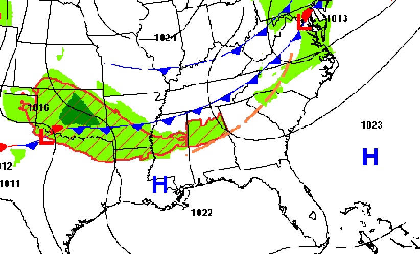
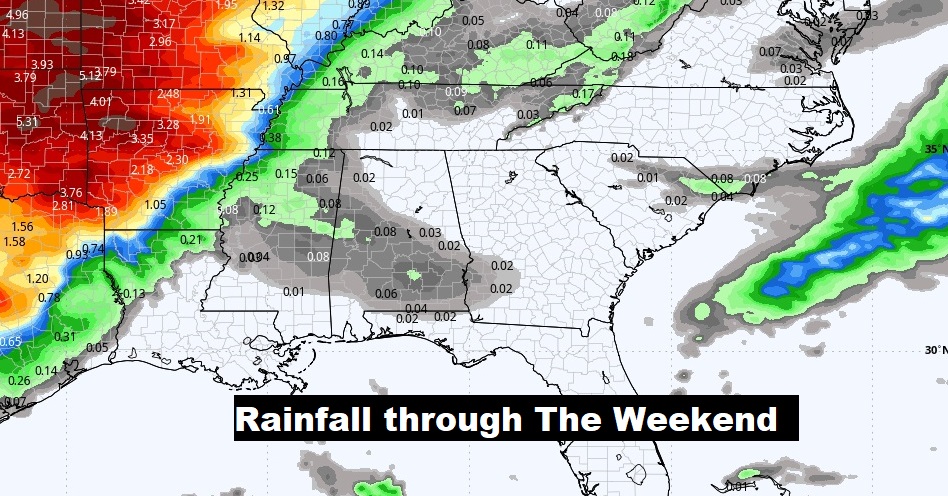
Good morning! Our chilly nights are fading. And, the afternoons will return to the 80’s today, and through the weekend and beyond. Meanwhile, a very weak southward moving front could touch off a shower or two, but I’m not convinced. I’ll keep the rain chance under 20% through tomorrow. If you have weekend plans..smile! It look a sensational late April weekend. Our severe weather drought continues. We’ll see what that early week storm system will bring. Right now, it looks like the approaching front will be less impressive when it gets to us. Here’s my brief forecast discussion.
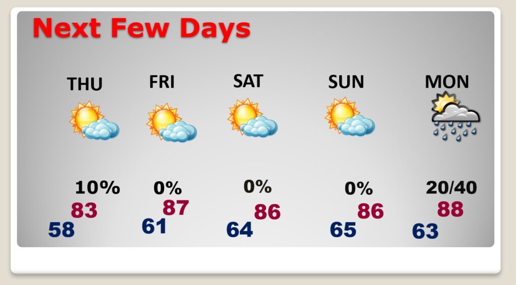
TODAY: Mostly sunny and warmer. High 82. Rain chance under 20%. Partly cloudy, not as cool tonight. Low 58. (Normal 81/54)
Spectacular Full Pink moon this morning. Moonset this morning in the west at 6:15AM. Moonrise tonight at 8:19PM.

NEXT FEW DAYS: Looks like a sensational dry/storm-free weekend with lots of sunshine. Highs in the mid 80’s. Lows in the 60’s. An approaching front will bring the risk of showers and a few thunderstorms back to the forecast early next week. Right now, it looks like the approaching front will be less impressive when it gets to us. Hopefully no severe weather.
.
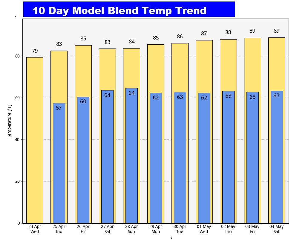
Here’s the 10 day temperature trend. Nice warming trend underway.
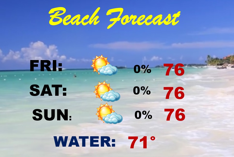
BEACH FORECAST: Great weekend Beach forecast. Plenty of sun. Comfortable temperatures. The Gulf water is still kind chilly.
Thanks for reading the blog. There will be another complete Blog update and video forecast discussion tomorrow morning. This morning, everything is normal including LIVE on the Radio from 6 to 9AM on NewsTalk 93.1 – WACV. Have a nice day!
–Rich